|
I. Introduction The Hillsborough Rural District covers 111 square miles in the north-west of
County Down immediately to the south of suburban Belfast. On the north and
north-west it is bounded by the River Lagan across which is County Antrim;
to the south the district reaches almost to the Mourne Mountains at Slieve
Croob, whilst eastward the boundary is not many miles away from the lovely
Strangford Lough.
 |
|
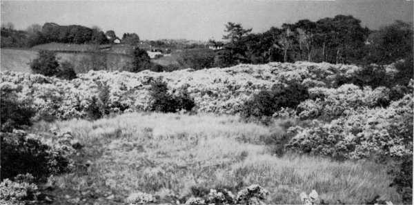
Landscape looking towards the Belfast Hill from Ravarnett |
The area is a rich farming district and like most of this part of Ulster it
is made up of small farms whose buildings dot the landscape. In the south,
amid a wilder country towards lovely Slieve Croob mountain are several
placid lakes whose waters are well known to anglers. In the north-west are
many areas of woodland which stretch to the lovely River Lagan and the
adjacent Lagan Canal. Both are anglers' haunts and both have long quiet
wooded reaches. Small towns and villages are scattered across the area and reminders of a
historic past include the prehistoric Giants Ring at Edenderry and the site
of an ancient battleground at Saintfield. Dromara is the centre for the
southern " lakes " and is well known as an anglers' centre on the upper
swifter reaches of the Lagan. Hillsborough is one of Ulster's pleasanter old
towns with the castle home of the Governor of' Northern Ireland as its main
feature of interest, whilst other villages of note are Newtownbreda, Drumbo
and Edenderry. Many of these places are within easy reach of Belfast and
form pleasant excursions for people from that city. The Maze race-course,
too, is a venue for Belfast folk - it lies north of Hillsborough and alongside
the Lagan. The whole district is a pleasant land of country and small towns and brings a
surprising glimpse of the best of rural Ulster to the very gates of
metropolitan Belfast
�Top II. Around the Rural
District Annahilt and
Ballykeel Annahilt is a small village along the Hillsborough to
Ballynahinch road. It is the site of one of the Rural
District Council's Housing Schemes and the estate is well laid
out in attractive surroundings. To the south and situated
where the Hillsborough to Dromara road crosses that from
Dromore to Ballynahinch is the roadside village of Ballykeel.
Between Annahilt and Ballykeel is the settlement of Milltown
which stands on Lough Agheny which is one of several Loughs in
this part of the district. North-east of Annahilt is Lough
Erne, whilst the two Bow Loughs and Lough Henney lie farther
east in the direction of Saintfield. Lough Erne is a
particularly attractive stretch of water. Lough Erne holds a
good stock of big trout, but the food for these at the bottom
of the Lough is so good that the fish are extremely difficult
to tempt by the angler. The other Loughs all yield rare
sport with pike, which are very numerous, and the occasional
large trout. The U.T.A. Lisburn to Ballykeel and Dromara bus
is useful for enabling anglers to reach these lakes.
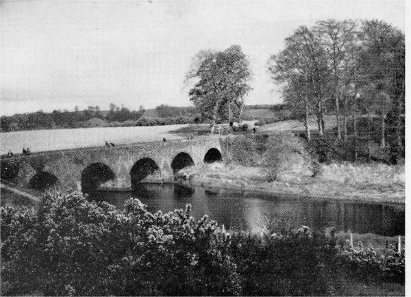
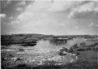
Ballyskeagh and Drumbeg These are two river Lagan villages to the north-east of the
town of Lisburn. The Lagan Canal also passes through
Ballyskeagh but is not now used for navigation. Hereabouts the
Lagan river and canal flow together and form the border
between the two counties.
 |
 |
|
Ballykeel Lough |
Shaws Bridge |
Pleasant tow path walks are
available through a land of rich woods, lush pastures and
well-tilled fields with an occasional linen mill here and
there. At this point the Lagan makes the greatest fall in its
43-mile course. The canal is under the control of the Roads
Division of the Ministry of Commerce, and permits, costing 5 -
for the season, may be obtained from tile Lock-keeper, First
Lock, Lagan Canal, Stranmillis Road, Belfast. The River
Lagan holds bream, perch, pike, eels, gudgeon and brown trout
and despite the fact that it is over-fished it still offers
superlative sport with brown trout. Credit is due to Lisburn,
Dunrnurry and Iveagh Angling clubs for
keeping, the river in such good condition and by their
restocking programme and supervision of the fishing. the Lagan
remains practically free throughout its course. Near Lisburn
is a long deep stretch inhabited by large pike and farther up
is good dry-fly trout water. Drumbeg is beside the river and
stands amid leafy lanes. The name means " little ridge." Of
interest are the fine mediaeval church with with its handsome
lych-gate and the
Drumbeg inn with one of the most peaceful and pretty rose
gardens in Ulster.
�Top Carryduff This is a rapidly growing area developing around a busy road
intersection on the Belfast to Downpatrick Road. In the
district is the Knockbracken Reservoir of the Belfast Water
Commissioners which serves part of the city of Belfast. Many
very attractive building estates have been developed in this
locality which is in an elevated position overlooking the
Lagan Valley with pleasant views of the Antrim Hills and the
Mourne Mountains. Main water supplies and a main sewerage
system are now in course of completion and sites have been
earmarked by the Council for Playing Fields.
Dromara
 |
 |
|
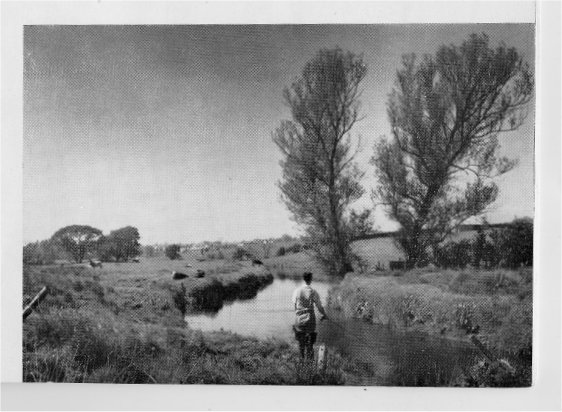
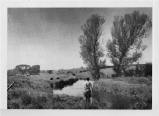
Fishing on the Lagan (Near Broomhedge). |
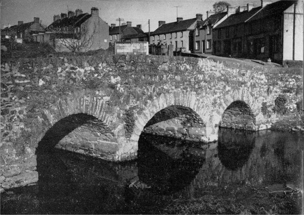
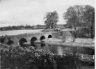
Bridge over the River Lagan in Dromara. |
Dromara is a busy little township in the very south of the
rural district with roads radiating to Ballynahinch.
Banbridge, Hillsborough and south to the coast at Dundrum Bay.
Above the houses of the town huddled in their valley rises the
I,502 feet height of Slieve Crook which is one of Ulster's
loveliest mountains and a northern " outpost " of the Mourne
range farther south. The Lagan river rises
on the northern side of Slieve Croob and descending
swiftly passes through Dromara en route to Belfast by way of
Dromore and Lisburn. Angling in the river here -indeed from
Dromore right through Dromara up to Slieve Croob is good with
trout to be expected at almost every cast.
North-east of Dromara is an agricultural land with numerous lakes to delight
both the angler and the lover of these quiet still stretches of water. Lough
Agheny is well stocked with pike, whilst Glassdrummond Lake near the road to
Saintlield holds pike and perch. These lakes may be
fished quite freely. In this area of fields and lakes is ancient
Mayheraknock Fort which is a reminder of former more troublous times.
�Top
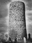
Drumbo and Edenderry
Drumbo is an agricultural village amid the fields and lanes that lie between
the Lagan and The " Lakes " of the southern half of the rural district.
Several Large estates including those of Belvedere and Trench House Lie
close to the village which is known for its ancient round tower (the only
remaining one in County Down).
 |
|
Round Tower at Drumbo. |
To the north of Drumbo are the villages of Purdysburn and Edenderry with
the famous Giant's Ring located between them. Edenderry with the adjacent
estate of Edenderry House is on the River Lagan which here follows a very
winding course. The Lagan Canal nearby cuts a straighter path across the
countryside. Edenderry (it means the " hill of the oak ") is a tidy little
village with attractive scenery by its river lock. Here are the famous linen
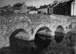
mills of John S. Brown and Sons Ltd. Close by also is picturesque Shaw's
Bridge so beloved by artists and photographers. The Lagan Canal is here in
one of its lovelier stretches near Shaw's Bridge. The Canal was constructed
out of funds amassed by a tax on ale and whisky sales in the locality during
the years from 1754 to 1764. In those days a pint of porter never exceeded
3d. and spirit was little more -yet �70,000 was built up for the Lagan
navigation scheme.
The Giant's Ring at Ballynahatty between Edenderry and Purdysburn, is a
very important Celtic and Druidical relic.It was most probably built as a fort or funeral monument by some
great Ulster chief some 4,000 years ago and every one of its huge stones was
carried by hand for some considerable distance. The 15-feet high ramparts
form a very regular circle with a diameter of some 350 yards around the central grassed area. Excellent views of the
Lagan valley and nearby hills is to be obtained from the top of these
ramparts. The circumference is composed of 7 sections which may prove that
the great prehistoric chief ruled over that number of tribes. In the centre
stands a dolmen of 7 great stones supporting one more in table form -
underneath was an ancient human burial site. Possibly an outer belt of stones formed an enclosure to the dolmen
(or cromlech) but no trace of this now remains. In a somewhat later period
this ancient ring was looked on as an object of superstition. Standing at
the centre by the dolmen nothing but the sky is seen, the ramparts cutting
off the outside world. One can imagine then, in this enclosed spot, the
awesome scenes witnessed in those long past decades.
�Top
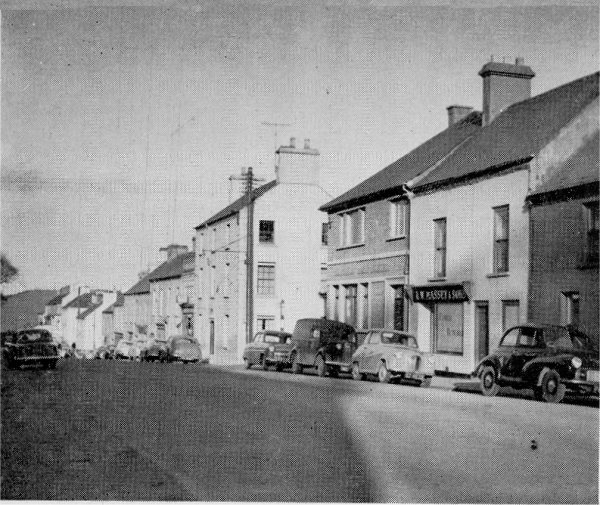
Hillsborough
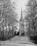 |
|
Hillsborough Parish Church. |
Hillsborough is a small and quite delightful town on the high road from
Belfast to Newry and Dublin. however, despite its busy aspect, it still
preserves an air of peace and the dignified houses run quickly down the
steep twisting hills of the town. The lovely parish church nearby is
approached by a splendid avenue of lime trees.
The town derives its name from Sir Arthur Hill who erected a castle here in
the reign of Charles I. Charles II made it a royal fortress and Sir Arthur
was constable with 20 warders. These have now been replaced by a company of
the Irish Guards but a bugler still carries on his traditional custom at the
parish church on Sunday mornings. The fort commanded the strategic pass of Kilwarlin and was used by William the third in 1690 whilst on his way to
light the Battle of the Boyne. The room in which he slept still remains in
the castle today. The castle is square with castellated turrets at each
corner and matching battlements along the top of each of the four main
walls. The town itself was built at this time by the Hill family, later the
Marquises of Downshire. To them it owes its rather English appearance.
The castle stands in a large and lovely park on the south side of the town
and is now used as the official residence of the Governor of Northern
Ireland. Strangely enough, a Royal grant is still given annually for the
castle's upkeep as a military fort. The Marquis of Downshire is a descendant
of Sir Moyses Hill whose estates reached virtually from Lisburn through to
Newry. A monument of the third Marquis stands on the hill top overlooking
the estates. In 1924 the castle was purchased by the Imperial Government
from the Downshire familv and here now lives the present Governor, His
Excellency the Lord Wakehurst, K. C. M. G., LL.D.
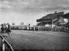 |
|
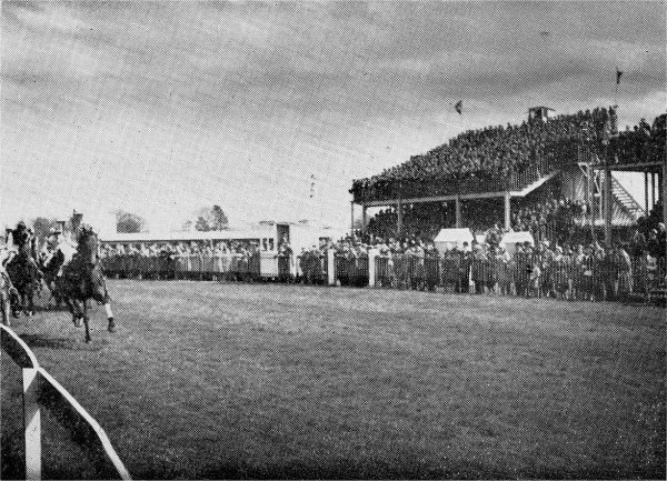
The Maze Races |
Near Hillsborough are the B.B.C.'s Northern Ireland Radio Station and the
very efficient Ministry of Agriculture Research Station. The Rural Council
has recently acquired the site of the former Downshire Hotel (an old
coaching inn) and here it is intended to erect a modern block to house all
the Council's services.
To the north of Hillsborough and just within the rural district is the Maze,
the oldest race-course in Ireland.(Mazetown, just beyond and over the
Lagan, is in Antrim.) The race-course is a historic venue where many
important races including the Ulster Derby, are run each year. The
race-course is owned by a very old association-" The Down Royal Corporation
of Horsebreeders " who were established in 1685 by a Royal Charter granted
by James II of " England, Scotland, France and Ireland "-" for the
improvement of horse breeding in the County of Down."
�Top
Newtownbreda
In the extreme north of the rural area, Newtownbreda borders the outskirts
of Belfast and has become a popular residential district for that City.
Despite this closeness to a large city, the original village of Newtownbreda
is still a pleasant place of old cottages covered in honeysuckle and with
roses in each garden. In the old churchyard is buried Richard Cox Rowe, a
celebrated 18th century comedian. His memorial stone quaintly says-" If 'er
thou was't claimed from dull anguish and woe, Pay a sigh-as a debt o'er the
relicks of Rowe."
West of Newtownbreda and bordering the River Lagan is the Deramore estate
and the Belvoir Park Golf Club. This beautifully wooded 18-hole course of
170 acres is very popular with Belfast golfers and is easily accessible to
them. The club house is loftily sited with Newtownbreda behind it and in
front fine views out over Colin and Black Mountains, Cavehill and much of
the city of Belfast. Belvoir Park (home of the Deramore family) has been
acquired by the Northern Ireland Housing Trust who are to erect 1,000 houses
here. The Rural Council also plan to build a further 350 dwellings here.
Close to Belvoir Park are found the Northern Ireland Fever Hospital and
Purdysburn Mental Hospital, both being sited in a wooded countryside.
�Top
Saintfield
Saintfield is the anglicised form of the Irish "Tonaghnieve," meaning "Hill
of the Holy." Nothing is known of how the place got this name, nor of its
early history, although the Norman Mound just N.W. of the town shows that it
must have had some early history. Tonaghnieve was in that part of Ulster "
planted " by James Hamilton from Scotland in the early seventeenth century,
but whatever existed at that time must have been swept away by the rebellion
of 1641 and even in 1658 after peace had been restored, there seems to have
been no regular village. General Price bought the Manor in 1709 at which
time the name of " Saintfield " was introduced. Harris writing in 1744
records that he " made a Town " and " opened and made passable the roads
from Belfast and Down through it."
With a resident Landlord the town began to thrive and all went well until
the rebellion of 1798 when Saintfield became a centre of the rebels. A party
of York Fencibles was ambushed on the Comber
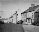 |
 |
|
Saintfield |
Gorse surrounding bog
where Betsy Grey was buried |
Road near the present Intermediate School and the victims buried
nearby, leaving behind them the name of " York Island " for the little
island in the marsh. The rebels took possession of the " Big House " of
Nicholas Price (" Bloody Nick " to the rebels, who was away in Dublin at the
time) but after three days moved on to Ballynahinch where they were defeated
by the regular forces. A number of the Saintfield rebels were hanged at
Downpatrick and others deported, including the Presbyterian Minister of
Saintfield.
When coaches and post chaises were introduced in the early nineteenth
century, Saintfield became a place for changing horses and a stable door,
high enough to enable the postillion to ride his horse into the stable, is
still to he seers in the yard of' McRoberts' Hotel. At this time the present
main road was made so as to reduce the gradients.
Not so many years ago Saintfield Fairs, especially the Horse Fair, drew
large crowds from far and near, but now the Fair Green is deserted and any
horses coming into the town are probably destined for the Horse Abbatoir in
the old Mill. The broad Main Street is a legacy from these Fairs much
appreciated by the modern motorist and the Churchyard trees and old Court
House make this street an attractive feature of the town.
A few miles south of the town are Rowallane Gardens, made famous by their
late owner, Mr. Armytage Moore and now taken over by the National Trust.
Thousands of visitors enjoy their beauty, every year, May being the peak
month. The gardens are open from April to September on Wednesday, Saturday,
Sunday and Bank Holiday Monday afternoons from 2 to 6 (2 to 9 on Wednesdays
in May and June). Admission is 2/- and teas and light refreshments arc
obtainable at weekends.
(These notes on Saintfield were kindly given by Col. M. C. Perceval-Price
of Saintfield House.)
�Top
III, Travel Information
Since the closure of most of the Belfast and County Down Railway system and
most of the Great Northern branches. the Hillsborough Rural District is now
devoid of train services. The Ulster Transport Authority, however, provides
an excellent bus service throughout the area. Time-tables ( I -) may he
obtained from [he L U.T.A. ollices at 21. Linen Hall Street, Belfast.
The following routes serve the Rural District:
| Service 12A. Comber-Saintfield -Ballynahinch (Daily). |
| Service 13. Belfast-NEWTOWNBREDA-PURDYSBURN-DRUMBO
(Daily). |
| Service 14. CARRY DUFF-DRUMBO (Daily) |
| Service 15. Belfast - PURDYSBURN - CARRYDUFF -
SAINT-FIELD - Downpatrick (Daily). |
| Service 18.-- Service 20. Belfast - PURDYSBURN -
CARRYDUFF - Ballynahinch - Newcastle (Daily). |
| Service 19. Ballynahinch-DROMARA - GRANSHA (Daily). |
| Service 22. Belfast-EDENDERRY-Lisburn (Daily). |
| Service 24. Belfast - BALLYSKEAGH - Lisburn (Daily). |
| Service 26. Belfast - Lisburn - BALLYCRUNE - BALLYKEEL
- DROMARA (Daily). |
| Service 27. Belfast - Lisburn - HILLSBOROUGH -
Donadeney (Daily). |
| Service 28. Belfast - Lisburn - HILLSBOROUGH - Dromore
- Rathfriland (Not Sundays). |
| Service 38. Belfast - Lisburn - HILLSBOROUGH - Dromore
- Banbridge - Newry ( Daily). |
�Top
IV. General Information
| Area |
The Rural District covers 111 square miles. |
| Banks |
Hillsborough-Northern Bank.
Saintfield-Belfast Bank: Northern Bank. |
| Education |
Primary schools are found at Hillsborough, Dromara and many villages
throughout the rural district.
At Hillsborough is a special school (" Beechlawn ") run for backward
children. At the neighbouring town of Lisburn are numerous primary schools
as well as Intermediate Schools and Grammar Schools both of which serve part
of the Hillsborough rural area.
At Ballynahinch are both Intermediate and Technical schools.
At Saintfield there is also an Intermediate school. |
| Electricity |
Supplied by the North of Ireland Electricity Board. Nearest offices and
showrooms are at Lisburn and Ballynahinch. Newtownbreda gets its supply from
Belfast Corporation. |
| Entertainments |
The Picture House at Lisburn. Continuous from 6.15 p.m. with afternoon
matinees on Monday, Thursday and Saturday and a morning, matinee for
children on Saturdays. Three changes of programme each week. No Sunday
performances. |
| Gas |
Supplied to part of the Hillsborough Rural District by the Lisburn Gas
Company. Offices and showrooms situated in Lisburn. Newtownbreda is supplied
by Belfast Corporation. |
| Golf |
'The 18-hole Belvoir Golf Club is found in the extreme north of the rural
district close to Newtownbreda in lovely surroundings. Three others are
found adjacent to the boundaries. These are the Lisburn Golf Club whose
9-hole course is at Lisburn just
a half-mile from the rural boundary: the Spa Golf Club ( I S holes) near
Ballynahinch and Dromara in the south of the area, and the Malone Golf Club
of 18 holes in the southern suburbs of Belfast not far from Newtownbreda. |
| Hospitals |
The Lagan Valley Hospital (200 beds) at l Lisburn and the 60-bed Lisburn
Hospital. Maternity needs are catered for at the Lagan Valley Hospital.
These hospitals cater for not only Lisburn Town but the whole of the area
covered by the adjacent Lisburn and Hillsborough Rural Districts. The
Purdyshurn Mental Hospital and Northern Fever Hospital are located near
Newtown-breda |
| Hunting |
The County Down Staghounds meet frequently in the district throughout the
season. |
| Local Government |
The Hillsborough Rural District Council offices are situated at Dublin Road,
Lisburn (Phone- 3l 17).
The officials are:
Clerk-Mr. J. C. M. Clague.
Engineer.-Mr. C. R. Mitchell.
Solicitor-Mr. D. B. Simpson.
Architect-Mr.
W. B. Maxwell.
Medical Officer of Health-Dr. S. Hayes.
Housing Manager-Mr. R. Greer.
Divisional Sanitary Officer-Mr. W. E. C. O'Brien.
Administrative Assistant-Miss M. J.
Napier.
Medical Officer of Health--Dr. S. Hayes.
Housing Manager-Mr. R. Greer.
Divisional Sanitary 0fficer-Mr. W. E. C. O'Brien.
Administrative Assistant-Miss M. J. Napier.The
Council's Building Inspector is located at Comber Road,
Saintfield (Phone-313). Council meetings are held monthly.
The Council has erected 478 post-war houses and plan the
building of a further 1,000. Extensive schemes have been
prepared for the redevelopment of Saintfield and Milltown,
Shaw's Bridge.
Public Health.
The Divisional Health Office for the district is at 414,
Ormeau Road, Belfast (Telephone 42905) which is the
Headquarters of the Medical Officer of Health and the
Public Health Inspectorate. Child Welfare Clinics under
the Down County Health Committee have been established at
Newtownbreda, Ballylesson, Boardmills, Carryduff, Dromara,
Drumbo, Hillsborough, Legacurry, Maze, and Saintfield.
Welfare.
The Divisional Welfare Office under the Down County
Welfare Committee is also at 414, Ormeau Road, Belfast.
Planning.
The Hillsborough Rural District Council is not the
Planning Authority for the area, having delegated these
powers to the Down County Council. The Planning Officer's
Headquarters are at English Street, Downpatrick.
Roads.
All public roads in the area are under the supervision of
the County Surveyor of the Down County Council whose
office is at English Street, Downpatrick. |
| Markets |
Weekly markets arc held at
Lisburn and Ballynahinch. |
| Newspapers |
" The Ulster Star "
(Saturdays, 4d.) and " The Lisburn Herald "-published in
Lisburn. " The Down Recorder " (Saturdays, 3d.)-published
at Downpatrick. " The Dromore Leader" (Fridays)-published
at Dromore. |
| Population |
The Population of the Rural
District at the 1951 census was 23,876 ( 11,742 males and
12,134 females). Today it is estimated to be 30,000. |
| Rateable Value |
�128,956. |
| Rates |
24/11 in the pound (1959/60).
(Of this 20/11 forms the general rate, the rest forming
the water rate.) |
| Industry |
The basic industry is
agriculture and the district includes some of the best
agricultural land in the Province. All types of farming
arc carried out in the area including dairy farming, mixed
farming and market gardening.
Other industries include textile weaving, dyeing and
finishing closely associated with the linen industry for
which Northern Ireland is famous.
Several parts of the area are ideal for large-scale
industrial development and sites up to about 80 acres may
be available for this purpose. Ample water supply can be
obtained (up to 600,000 gallons per day from mains supply;
about 10,000 gallons per hour from artesian wells). Easy
facilities for disposal of trade effluents. The areas
adjoin the new " South Approach Motorway " at present
under construction and this new roadway will provide easy
access to the district for transport of raw materials and
manufactured articles. Passenger transport and electricity
supplies are already available.
A large pool of skilled and semi-skilled labour is
available in the district and adjoining towns. Many of
these are already skilled in the textile or engineering
industries and most have a long family tradition of
craftsmanship. |
Whilst every care has been taken in compiling this
guide, and the statements contained herein are believed !n he
correct. the publishers and the promoters of this publication
will not hold themselves responsible for any inaccuracies. �Top |