|
|
|
||||||||||||||||||||
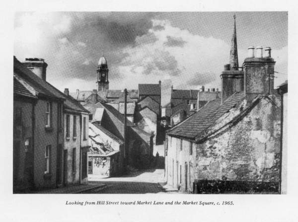
These car-parks are like a cancer eating away at the open spaces, until, if we allow it to happen, there won' t be an open space left: Can someone suggest a cure? Have you observed Mr. Smartt's premises above the shop? One of the oldest buildings, and, such a nice oriel window. Look at the, old roofwork, small slates at the ridge and gradually getting larger towards the eaves-gutter. This house used to have a garden at rear which had that lovely dark red rhubarb growing, which made such, lovely rhubarb tarts really mouth-watering. But you have to be inside this house to realise how artistic and comfortable was the architect's conception of what a home should be. Mr. and Mrs. Smartt, very wisely, have not changed the interior design, but have added modern furnishings which enhance the old-fashioned beauty. In the front sitting-room there are two large wall paintings, that is, oil paintings directly on the wall, instead of wall-paper., One, is of "Isole Bella," an island on lake Maggiore, Switzerland, and the other the "Island of Gozo," near Malta.,They were painted by a former resident of the house. There is a tradition that this house is one of a very few which was not burned down in the. accidental. fire of 1707, when the town was destroyed, The Savings Bank was said to be another house not burned. If you look at the front wall of this bank, you will see a date-stone with the letters "MM" and the date "1709." The tradition may be quite true. Mr. Smart and, his good wife can sit in this lovely interior surrounded by old-world-charm and watch the,ceaseless frenzy of today rushing past the oriel window. What a change for them when the pedestrian precinct finally evolves and Market Square becomes its old quiet self. Maybe we might even have the market back on special occasions, for old times' sake? Please read the poetry on the plaque on the north wall of the Corner Cafe. It is most interesting, but where was it placed originally? I am sure there is a good story here if we only knew. In 1819 there were 45 householders in the Square, and with
the exception of two ladies and two gentlemen, who apparently had no occupation,
they all had a business of some kind: five publicans, two muslin manufacturers,
one linen damask manufacturer (Coulsons) three woollen drapers, two inn-keepers,
one surgeon (Dr. Musgrave, at the Savings Bank site), one spruce-beer maker,
three pawnbrokers, and one baker (just like today), and one retailer of delft,
and a few others. But to all the businessmen Market Square was the place where the money was made. As we are dealing more with places than people we have just scratched the surface of the history of Market Square, and we must push on. The streets off Market Square which we have not mentioned previously are:-Market Lane, Market Street and Railway Street. We will have a look at Market lane, a very old thoroughfare, in existence before the other two streets and indicated on the Town Plotte of Lisnegarvey, 1620. It led from Market Square to a lane at the far end of Hill Street, which lane ran down to the Lagan River. There may have been a ford here as the road to Dublin, the old Hillsborough Road, was beside the river on the other side. Also, there was a fort at the top of the Hill street, and the lane to the river must have been used at that time. The Fort area is now a housing estate. I think there is some confusion about the name of Market Lane. Some call it Market Lane and some Piper Hill. From my examination of the old maps, I find that the portion from Market Square to Linenhall Street is Market Lane; the portion from Linenhall Street to Back Lane (Laganbank Road) was Piper Hill, and the rest, the high part, was named as a continuation of Piper Hll or the Hill Street. The few houses on the left just past Bank Lane, were known as "Hillmount Row." This was before "Sinclairs Row" was built on the other side. The old houses which were in Market Lane and those just
opposite Linenhall Street had cellars, used as stores or weaving shops. I have
been down in these cellars, but alas! there were no weavers and no weaving.
The entrance to the cellar was gained by the lifting of a trap door in the kitchen or hall floor, which revealed wooden steps, and you went down to the earthen floor. These houses are now down, but you can see where the ground floor door and window openings have been bricked up in the existing portion of the front wall on the left. This wall is all that is left of the Market Lane houses. In 1919 there were 21 houses in Market Lane and 23 in Piper Hill. Hill Street is not mentioned in the directory. The sight of the soldiers in their gaily-coloured uniforms must have been commonplace in Piper Hill and Market Lane in those early days, coming and going to the barracks in Barrack Lane, and the sound of the bugle must have reverberated round the houses. If there are any such things as ghosts they should be here. In the year 2000, maybe there will be a pageant and the soldiers will again march down Piper Hill, one of them "with his bead tucked underneath his arm," If he is not there, I'll feel like asking for my money back. Next, Market Street. What can we say about Market Street? Not much, I'm afraid. Just a connecting link between Market Square, Smithfield and the Markets. There was a row of dwelling-house shops on each side. It was named "The Old Shambles" at one time and a part of it "The New Shambles." This name referred to the slaughter houses in Browns Entry. A kind of commercial slaughtering place with the By-wash receiving the effluent and taking it to the Lagan. The Shambles were erected in 1796 by the Marquis of Hertford. From 1929 to 1939 the private slaughter houses were more scattered and were usually behind the butchers' shops. The owners were: John Magee, Bridge Street; Pat Laverty, Bow Street; Jacob Green, Bow Street; John M. Cummins, Bow Street; Robert McMullen. Causeway end. William Drake had a slaughter-house behind No.13, Bow Street; Wm. Laverty, Chapel Hill; Drake Brothers' premises at Smithfield (wool shop now). It is still there. There is no slaughtering of animals in Lisburn now. Market Street is not mentioned in the 1819 Directory. I am of the opinion that Market Street was never looking so tidy and prosperous as it does today. The Presbyterian Church alterations have been a great help in making a very nice entrance to the street. The Christian Workers' Union Hall was, in 1914, "The
Lisburn Electric Picture Palace;" and before that it was a Methodist
Chapel, The original chapel was built about 1774 and rebuilt 1789. It was in
1789 that John Wesley preached in it.
|
|||||||||||||||||||||


 |
|
Miss Stannus c. 1890 |
Have a good look at the buildings I have mentioned, and
also at the houses from top to bottom and from front to back, even to the boot
scraper beside some of the front doors, a sign of the old mud roads.
And admire the little gardens still left behind some of the
tall houses. Don't forget the Friends' Cemetery. It may be a sobering influence.
In looking at the old estate maps I noticed an interesting
piece about the cricket field. In 1855 the field was rented as a grazing field
to John Finlay and then transferred to James Kidd in November.
In 1857 it was in James Kidd's name until November, when it
was rented to the Cricket Club. The acreage was: one acre, three roods, 36
perches, and a further one acre and eight perches was added to it from land
rented by Pat Gelstone, making a total of three acres and four perches.
Pat Colston had grazing land surrounding the cricket field,
including what is now the tennis courts.
In 1877 Joseph Kam was stated to be the secretary of the
Cricket Club and the area was then three acres and five perches and held on an
annual rent of one shilling.
![]()
Street Names of a
Bygone Age
You may remember that in my chapter on Railway Street I
mentioned that its name had been changed from Jackson's Lane, and I suggested
that a further change could be considered which would be appropriate to its
position as a leading thoroughfare.
Since then I have been doing some research and have found
on old maps and records names for streets, roads and lanes which are no longer
remembered, but which were the official and local names for the highways of
Lisburn of a bygone age.
This desire to change an old traditional name for another
more up to date still persists and is happening quietly today. A well remembered
name with perhaps a lifetimes associations and memories disappears.
For instance, do you know where Largymore Drive is? Quite
recently it was Plantation Lane and further away in 1837 it was "The
Clogher Hill Road." If in that early period you were going to Plantation or
The Clogher, your route was Hillhall Road, Clogher Hill Road, turn left up what
is now Plantation Avenue, and on up over the hill.
It is good to see "Plantation" being preserved as
part of the new title because of its link with the tradition of the
neighbourhood-come to think of it, Largymore Drive has a lot in its favour.
It was in Plantation Lane, in a thatched cottage belonging
to James McNally that the last of the handloom weavers in Lisburn, who had a
loom in the house, ceased to weave about 1935. I remember being in his weaving
room after a heavy rainfall had flooded his cottage and seeing the bobbins and
other odds and ends floating around.
Shortly after, he left and went to work in Lurgan. The
last, as far as Lisburn was concerned, of a dying home craft. The end of an era.
I believe you can now take it up as a hobby. The horse has followed the weaver.
The Lisburn Historical Society has a hand-loom given by Sir
Ivan Ewart, but it has yet to be erected and put in working order. A souvenir of
Lisburn's one-time staple industry. In the 1819 street directory of Belfast and
Lisburn there were over one hundred weavers mentioned as householders in
Lisburn. Many of them and other members of their families, working for William
Coulson in Linenhall Street and Market Lane and at Sprucefield.
Other weavers had their own looms and received the raw
materials and wove the brown cloth at home, like the man in Plantation Lane. The
whole countryside at this early period was peopled with small farmers who had
weaving as a supplementary means of really keeping alive.
Life was very tough, and those long, low thatched cottages,
so picturesque now, had "the shop," as the weaving-room was called, in
the end room, and the whole family helped with the weaving.
Take a walk out the winding Broomhedge Road, which was, at
one time, the only road to Moira, and have a talk with some old inhabitant, and
you'll hear the story at first hand.
![]()
I've got completely away from my subject of street name
changing, but before we return to it I would like to say a word about, the
Causeway End, which is, in my opinion, the oldest road in the Lisburn area.
It is unique in structure and in the type of dwelling still
there to be seen, and the beautiful views away to Slieve Croob and the Mournes
on one side and Colin and Divis on the other.
It is an Esker, that is, a pile of sand and gavel left at
the end of the glacial period twenty thousand years ago. There are other eskers
in other parts of Ireland, some of which are also used as roads.
It is the townland of Knockmore, which is the "Great
Hill;" probably from the height of the Causeway which stuck up out of the
low land and bogs through which it runs. The sand pit at Aickin's Hill, at the
borough boundary, which is now being filled in, will give you some idea of the
depth of the sand and gavel.
It is called Causeway End, but where does it start? Down
about Finaghy, and extends right through to just past Brokerstown Road. I
remember a drain being laid in what is now the Fire Authority gateway in Castle
Street and the trench was dug through sand and fine gavel, the soil of the
esker.
Do have a walk along Causeway End, take it easy, and look
at the mixture of modem dwellings and the sometimes venerable, very old ones.
The houses seem to suit the road very well. They are not all nice, some are
really poor, gone beyond recall. But some are real fairly-tale material and
fitting subjects for the artist.
Until recently, the people got their water supply front
springs and a stream alongside. There is a well in the valley opposite No. 106
which has never been known to run dry, and is still running.
Before I retired I had the privilege of recommending that a
watermain be laid along the road, which was afterwards done. One day I was along
making an inspection and went down to see the well and to my surprise some
ducks, having a bathe, flew out with a great flutter and quacking. It made the
water-main idea more urgent.
There's always a snag somewhere, isn't there? More of the
road is a 30 miles an hour speed limit, but a part is de-restricted and you can
now speed up and hurry past what the people call "The Dump." This is,
of all things, a car cemetery, and other activities which seem to be going on.
It's a complete surprise and is a terrible let-down for
those persons who are keeping their holdings in such lovely condition. Can
anything be done?
Changes are afoot up Causeway End these days. Planners with
maps have been around. Factories and houses have been mentioned. Progress is
about to raise its head and look around at this almost idyllic scene.
Are we to lose this little piece of Knockmore or can
anything be done to make it even more attractive, more a beauty spot, a tourist
attraction, or am I just talking blethers.
![]()
Something has been done! or at least recommended. In the
Belfast Urban Area Plan, it is stated: "Causeway End Road to be preserved
as a wooded green finger'-and if you don't believe me, call at the Town Hall,
Castle Street, and you will see the map yourself.
Don't wait until the bulldozer is pushing in your back
door, it'll be too late. Great changes are foreshadowed for all the Lisburn
area, and you are involved.
My goodness! When I get on a hobby-horse, I don't know when
to get off. Once more to the changelings, and we'll take them more or less in
alphabetical order. The present name first and the former names after, with a
date here and there as I have noted on the maps.
Antrim Road-Glenavy Road, 1838; Antrim Street-Antrim Lane,
1819; Ballynahinch Road-Black Loanen, 1946; Barrack Street-The Rookery, 1862;
Basin Lane-Beggar Lane, 1819.
This lane at No. 9 Seymour Street led up to the basin or
town reservoir, now the pond in Wallace Park. From the basin a part of the town
got a supply of water in wooden pipes-tree trunks with a hole bored up them. Sir
Richard Wallace received payment for the water supplied.
Bow Street-Bow Lane, 1819; Canal Street-Track Line, Lane or
Road, 1819; Castle Street-The High Street, 1650; Cromwell's Highway -Trumbles
Highway, 1833; Trumills Highway, 1868, and Trimbles Highway, 1914. It was the
road joining Hillhall Road to Saintfield road before Mercer Street was built,
and, of course, Cromwell never was here.
Dog Kennel Lane-Kennel Road, 1841; Kennel Lane, 1859;
Lovers' Lane, 1900. The Killultagh Hunt Club had their kennels at the Duncan's
Road end.
Graham Gardens-Tanyard, Tanyard Lane. Had private houses,
tanneries and a brewery which turned out over 5,000 barrels of beer yearly.
Gregg Street-Bridge End, Bridge End Hill, 1819. Used to be
the road to Belfast. Was in line with the original bridge over the Lagan.
Stannus Place houses were parallel with the old street named Bridge End.
Grove Street-Kennedy's Avenue or Road. Samuel Kennedy, of
Grove Green, had a flour mill on the site of a bleach green about 1817.
Kennedy's Avenue-May have been a private road, as there was a gate lodge-like
house inside the wall until fairly recently, at the Grand Street end.
This house is on the 1836 map. Some of the older people of
Grand Street will remember it.
Haslem's Lane-Hazel Lane, Haslim's Lane, Haslam's s Lane,
1819.
Hillhall Road-called "Old Turnpike;" at the M1
end.
Herons Folly-Herons Alley; Hill Street-Piper Hill, 1819;
Hillsborough Road-Dublin Road, 1835; Howard Street-Phillips Court, 1968.
![]()
Lagan Bank Road-Back Lane, 1940; Longstone
Street-Longstone, 1819; Manor Park-Johnstons Lane, 1840; Market Square-The
Market Place, 1650; Market Street-Old Shambles and New Shambles.
Millbrook Road-Mill Read. The road to the corn mill later
used and very much enlarged for linen manufacture by Richardsons of Glenmore. It
had one of the largest waterwheels in the country to work the "beetling
engine." Call down and see the ruins.
Lower Millbrook - Kilrush. In P. H. Joyce's "Irish
Place Names," he gives the meaning of "Kilrush" as "The
Church of the wood or peninsula." I wonder is there a church buried beneath
that great untidy pile called Kilrush graveyard. Perhaps you have never been in
Kilrush graveyard? You couldn't care less? Well, I suppose that's the attitude
that has brought this old graveyard to its present state of broken headstones,
overgrowing bramble (the blackberries were delicious) and general appearance.
Although, mind you, it is in better shape now than some years back. The barbed
wire and good fencing have stopped the rot, but I'm afraid, too late.
However, it is worth a visit and you can get the key of the
gate at the Town Hall. There are some fine yew trees and a large tree which
looks a fine specimen (I'm no good at tree names) and some headstones, though
lying in sixes and sevens are worth reading. There is one to Elizabeth Johnston
of Bridge End Hill, so the name "Gregg Street" was still not in
general use even at 1860 when she died. Remember, the old bridge was still in
use until 1880, when the Union Bridge was built.
The oldest readable headstone which I saw was one to a
person named Chapman, 1728, but there are very old stones half buried and with
inscriptions gone. There is a very ornate memorial to the Beatty family, erected
1838. The inscription is on a large slate inserted slab, and is as good as the
day it was cut. The slate headstone seems to be out of date now. Not flashy
enough.
I was looking for a headstone which was in memory of a
black servant who had been brought from Africa by one of the wealthy residents
of the neighbourhood and who died of consumption. I saw this stone thirty years
ago, but it must be overgrown, as I couldn't find it, and, of worse, there are
the iron railings round graves with the shield with the name of the owner. The
iron lasts a long time, even when neglected for as long as one hundred years.
All was peace, except for some noise from a nearby
workplace and a barking dog that followed us around, hoping we would play with
it. We didn't; you would break your leg over the humps and hollows if you tried
to walk fast, let alone run.
Coming away and looking back, I thought of Gray's Elegy
Written in a Country Churchyard, which I had learnt at school, and here is a
verse:
Beneath those rugged elms, that yew trees shade,
Where heaves the turf in many a mould�ring heap,
Each in his narrow cell for ever laid,
The rude forefathers of the hamlet sleep.
We locked the gate and stole quietly away.
![]()
Largymore Drive-Plantation Lane, Clogher Hill Road, 1837;
Pond Park Road-Stoneyford Road, 1846; Railway Street-Jackson's Lane, 1843;
Schoole Room Lane; Ridgeway Street-Pump Lane.
Saintfield Road-Largymore New Road, 1843; Seymour
StreetBelfast Gate, 1819; Sloan Street-New Bridge End Road, 1880; Smithfield
Street-Church View; Tonagh Avenue-Priests Lane, 1855; Maginnis Lane.
Warren Park-Sandy Lane, Dorgan's Lane, New Lane; Woodland
Park-McKee's Lane, 1849; McKey's Lane, 1851; Garrets Lane, 1855: Second Sandy
Lane, 1835; Thornleigh Drive-Dummy's Lane, Dumble's Lane, Dumvilles' Lane.
The lane is marked as a public right-of-way on the 1876
Wallace Estate maps. There were quite a number of such rights of way, but they
have long since disappeared. Can rights of way become extinct? This lane joined
Causeway End at Aickin�s Hill to the Antrim Road. Perhaps the new development
will follow the old pathway.
Young Street-Old Hillsborough Road, 1839; Meeting House
Lane, off Hillhall Road-Campbell's Lane, 1839-Wesley Street, Fort Street, Low
Road, Grand Street-The Lower Road.
Benson Street was known as "The Fairy Well" and
Fairywell Street.
And so the change goes on and on, but it happens so slowly
and quietly we don't notice it. However, do please have a long look at the
Planning Proposals in the Town Hall and get to know what the future holds in
store.
I have just received a copy of "The Ulster Link,"
the monthly magazine of the Northern Irish in Australia and New Zealand. It is
the August edition, 1970, and it has specially featured Lisburn history, and
gives the names of Lisburn and district people who have gone to live in
Australia and New Zealand.
There is a letter about one, William Hicks, born in
Lisburn, who died on January 28, 1867, at Sydenham, Belfast. He was buried in
Kilmsh graveyard. I saw his grave the day I got "The Ulster Link:" A
coincidence.
![]()
Help
for the Widows from the Canon
In the times when the Welfare State was undreamt of, every
family had to rely on their own efforts to feed and clothe themselves and store
up something for the "rainy day," or it was the workhouse when hard
times arrived, which was very often.
In the 1800s times were very bad, unemployment was rife,
sickness everywhere and typhus fever stalked the land, killing more than the
famine. It was a terrible period in Irish history during the "hungry
forties:"
In a "Concise History of Lisburn, and Neighbourhood,"
it states that "John Handcock imported from Philadelphia two hundred tons
of Indian meal, the first sample of that article ever seen in Ulster."
He also brought over five hundred barrels of American flour
and both were sold at cost price to the "more distressed families in
Lisburn." Hancock Street reminds us of this family.
Of course there were other people who formed relief
committeeas and assisted the poor and distressed in many ways.
This brings me to the "Widows Houses" on the
Belfast Road, built at this time to house elderly widows. One was under the
control of the church and the other, private individuals.
In 1928 the rector of Lisburn Cathedral, Canon Taylor, was
in charge of the Widows' House which was on the now vacant site between the
Methodist Manse and the entrance to Forthill School, Seymour Street. And Miss
Pim, of Ogles Grove, Hillsborough, was the person to whom repairs, et cetera,
were referred at the other Widows' House, which was on the triangular piece of
land at the junction of Belfast Road and Belsize Road.
There is now a notice put up by the Woodlands Hotel on the
site, and below it is the heap of stones and rubble which was the house.
A word about the construction of these Widows Houses would
bring back memories to those who knew them and be of interest to others.
Canon Taylor's house was of peculiar construction. It had a
slated roof, eight separate compartments, each with a bed-sitting room,
fireplace and door to the outside, the only door.
There were two storeys and had four rooms up and four down.
As the ground fell away to the rear, the top four apartments were level with
Seymour Street and the bottom four apartments level with Eagle Terrace, and
looked in that direction. Thus were housed the eight widows, rent free.
![]()
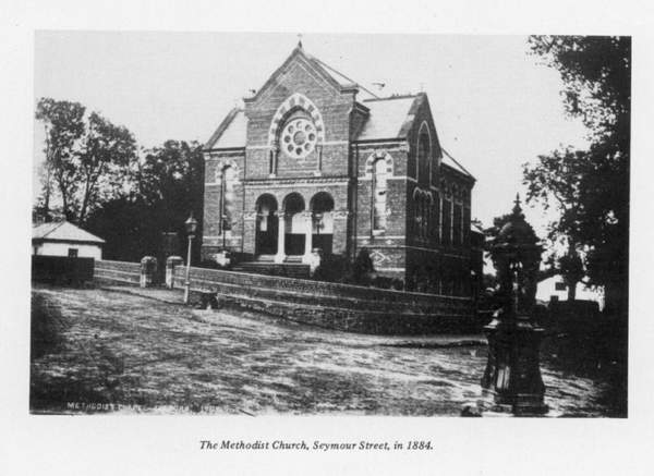 |
|
Methodist Church c 1884 |
Miss Pims' Widows' House was a single storey, square
shaped, slated building which housed four windows in four apartments. Each had a
fireplace. The front door opened on to a passage which led to the rear door and
there were two apartments on each side with a door which opened to the middle
passage.
Miss Pims's houses were built by James Williams in 1826,
and the Widows' Houses at the Methodist Manse were built by the Marquis of
Hertford in 1832 at a cost of �120.
The Widows' Houses are no more; the necessity for them is
no longer with us. With the coming of the Welfare State benefits, the old people
can pay their way and are welcome to stay at home.
Before Miss Pim's house was finally demolished, there was a
tragedy. The house had become derelict and was being used by itinerants, and one
winter, two of them, a man and a woman, were found dead in one of the rooms. A
sad end; death from exposure. The Council had the house demolished.
Footnote: Amongst the heap of stones is the date
stone which was above the front door. It will be uncovered some day and perhaps
the Lisburn Historical Society will get it as a memorial of a worthy expression
of help in those dark and dismal times.
In my travels along the highways and byways where the
people of Lisburn lived and died, I have thought, where are they all now, where
did they find a place for them finally?"
This brought me to the subject of cemeteries, graveyards or burial grounds, where these worthy people were laid to rest, and a desire to visit them.
I must confess I am a person who almost enjoys a walk
amongst the headstones. I do not think so much of the people as dead, but rather
of persons who have been alive and going about their daily duties and homely
tasks and enjoying life, and who are now enjoying it more abundantly.
The graveyards used by the Lisburn people were principally
as follows: Old Blaris, Lambeg, Cathedral, Derriaghy, Chapel, Lisburn Cemetery
and Hillsborough Parish Churchyard.
As we have already visited Kilrush and Friends' Railway
Street, we will leave them out, but keep them in memory; they are well worth a
visit.
![]()
Now for our walk round and a chat with the caretakers, who
really are the men who know what is going on and what is most interesting. There
have been books written about some of these graveyards and the adjoining
churches- especially the churches-for those who would like to study their
history.
We, however, are just passing in and out; we are not
staying- at present !
Our first visit is to Blaris Old Cemetery, and the first
thing that strikes you as you approach is the newly-painted gate and the cottage
inside. A real picture of what a prosperous Irish cottage should be: clean,
neat, in good order, no litter, with a well-kept flower and vegetable garden in
front and the "street" or road to the cemetery between the cottage and
the garden.
The Hillsborough Rural Council are indeed fortunate in
having such an industrious man and wife, Mr. and Mrs. McCarthy, in their
cottage. Mrs. McCarthy's family, the McCamleys, now spelt "McCambley;' have
been in occupation of the cottage for about one hundred and seventy years, that
is, since 1800. A truly worthy record of service by a family.
People have been decorated for less useful service.
I was surprised to hear that just inside the gate to the
cemetery, on the right-hand side, are the graves of some of the 1798 rebels.
Tradition states that there were four rebels who were
brought from Belfast, with their coffins, in a cart. They were shot outside the
cemetery, placed in the coffins and buried. There is no memorial. I�ll have to
find out more about this interesting story. It could be true.
Human life was of little importance in those days, you
could be hanged for stealing five shillings worth of goods.
The graves are like those of Kilrush and came into being in
probably the same manner. They are scattered about, and up and down at all
levels, but mostly well attended.
As the cemetery is still in use, there are some very nice
modern memorials and this small burial place is still very much
"alive" if that's the right word. It�s a very fine example of an old
graveyard when the ecclesiastical building has crumbled into stones and earth,
and is no longer visible.
There is a part of a wall, creeper covered, which is said
to be all that is left of the sacred edifice which was in use when the Lisburn
Church was built in 1623.
The history of the early Blaris Church is lost in antiquity
and the site is a mound of grave plots. It must have been always regarded as a
great privilege to obtain a last resting spot inside the church walls, and, of
course, it still is, if you are of sufficient importance.
But, really, it doesn't make a button of difference whether
you are laid inside the walls or outside. So don't let it worry you.
![]()
There are two rather solid memorials to two officers of our
once far-flung empire. Two eminent Inspector-Generals of the Chinese Customs,
Sir Robert Hart and Sir Frederick Maze. They are almost identical, except that
on the Hart memorial, on a copper plate, is a statement in raised lettering in
Chinese.
It's nice to think that two such men had their upbringing
in the Lisburn area. There are Harts and Mazes still around. The two memorials
are of the polished, pinkish Mourne granite, and must weigh a couple of tons
each. I think they would be of oriental design.
Choose a nice bright sunny day, and come out to Blaris for
an hour and you will see the names of a good many Lisburn people. Don't go on a
wet day, for there's no place more depressing than a graveyard on a wet day. The
oldest headstone is dated 1626.
On leaving, I was shown an old baptismal font which had
been hollowed out of, I would think, sandstone. It was lying at the side of the
cottage, a relic of the past around which our ancient forbears and their
off-spring gathered for a few minutes at a christening.
There was a similar font in the Shankill Graveyard,
Belfast. It sat with the bowl upwards and was called the "Wart Stone."
If you had a wart, say on your hand, you stuck a pin in it (the wart), dropped
the pin in the water (it was always full of rainwater) and the wart went away.
At the bottom of the bowl there was always several inches
of pins from satisfied customers. You don't believe me? Well, take a run in your
car to St. Matthew's Church, Woodvale Road (it's near the graveyard) and you
will see the "Wart Stone" on a pedestal outside the church. Try the
cure !
Don't blame me if your hand falls off. And have a look at
the lovely �Garden of Rest,� which was the old graveyard on the Shankill
Road.
Do you think it would be a good thing to have these ancient
graveyards classed as "ancient monuments" and looked after by the
appropriate ministry? I do.
Now this is another burial place with a long record and
also a good deal of speculation as to its origin and past. Tradition is again on
the job, and a monastery, a nunnery and a church are mentioned as being
hereabouts. We know for sure that the church is a fact, for we can see it, with
the tower as its oldest part You will see the wheel and bell on top, Lambeg
Churchyard.
This churchyard with its church on the banks of the Lagan
is worth a visit. The linen lords of the past are interred here, and to read the
inscriptions on the headstones is to take a peep into linen history. The
Barbours, Wolfendens and Richardsons have been laid to rest beside their
workers.
There are Protestants and Catholics, clergy and priests
some Huguenots, including the Rev. Saumarez Dubourdieu, who lived in Seymour
Street (then Belfast Gate). He had a school in Bow Street. In the 1819
Directory, the "Misses Duberdieu" resided in Seymour Street. I would
say these were his daughters.
He died in 1812. The book, -The Parish of Lambeg,"
gives some interesting facts about his life. Well worth reading, it's in the
Library, Railway Street.
![]()
I think anyone who has taken an interest in Lambeg
graveyard knows about Essy Pelan's broken romance. In fact, it's a wonder that a
story has not been written about her and her lover. Perhaps it would be too sad.
For those who dont know the story, here it is:
Essy and her sweetheart were, to all intents and purposes,
engaged to be married when he took the notion to go to America to make a
fortune. They parted, he promising to come back for her as soon as possible. But
time dragged on and on, and he didn't come back to Lambeg. She heard he had
found another girl, and she was overwhelmed with grief.
She took ill and died on her twenty-fast birthday, 1833,
and was buried in her bridal dress. Well, he came back, and to his great sorrow,
found his bride to be dead. He put up the memorial, a broken column, in her
memory. The inscription tells of his love for her and her love for him.
Do look round for Essy Pelan's grave and read the
inscription, and take note of the broken circle of chain, the links open at the
bottom, and the words "Separated below, but united above." He made a
fortune and lost his sweetheart. I wonder who he was, bow long he did stay away,
and Essy waiting. Anyone know him?
Take a walk up the new part of the graveyard and look back
at the church, with the Lagan river in the background. It will be a nice memory
picture of Lambeg Church and Churchyard.
Christ Church Cathedral and its graveyard have been in the
centre of Lisburn and all its activities since 1623. Destroyed in 1641 and 1707,
but still maintains its position as the Cathedral Church. The graveyard is not
now in use and is mostly on the north and south sides of the church.
It's a great pity that the church is surrounded by business
premises, as I'm sure a great many persons pass through the town and never see
it.
Market Square
Presbyterian Church has now come from behind the barricade of shops, and the
church, Square and the town have been enriched by its new appearance, Could the
Cathedral some day emerge from its modest retirement?
Now for our walk through the graveyard to look kindly on
the memorials of the Lisburn people of a by-gone era.
Well go in by the Castle Street entrance. The shop on the
left of the gate, which until recently was the sextons house, and is now a house
agent's office, was in the possession of Sir Richard Wallets to 1876 and was the
Post Office.
In the 1819 directory, Felix Cunningham lived in Castle
Street and was the postmaster, and very likely lived in this house.
Here we are in the graveyard, near the vestry entrance to
the church, and on our right is the grave plot of the Hogg family, one of whom,
Clare, was the mother of the great Nicholson. There are two tombstones here and
you can see that some of the Hoggs lived to a ripe old age. In fact, Rose died
aged 102 years. At a time when the average age was about 40 this was remarkable.
![]()
We go round between the Sunday School, dated 1885, and the
church, and into the south side of the graveyard. On the left is the Crommelin
Memorial, with the headstone details set out on plaques on the railing round the
grave. There is also a copper or bronze head of Louis Crommelin in relief above
the plaques.
This memorial to an historical figure is a must, the last
resting place of a great linen pioneer.
A good many of the memorials are of sandstone and would
require some preservative treatment to prevent further deterioration, but sure
this applies to all old graveyards.
Here are a few memorials worth examination-one to a
"Mr. James Truefet and Mrs. Jaine, his wife. She died about 1725." A
bit uncertain of the year. You'll note the "Mr. and Mrs." Not often
seen, but there's another one, a "Mr. John Busby, a writing master."
James Vernon died 1886 aged 83. The Vernons were builders
and this one may be the builder of Lambeg Church.
Benjamin Neely, school master, had a school in Castle
Street. He had two children died on the same day.
There is a huge railed-in memorial to Doctor Samuel
Musgrave, who had a practice in Market Square in 1819.
John Crossley, Jnr., an education pioneer. Do read this
memorial.
Very Rev. James Stannus, A.M., Dean of Ross, and agent to
the Marquis of Hertford. The "Dean's Walk" in the Wallace Park was
named after him. Rev. Snowden Cupples, D.D., who gave Henry Munro communion on
his way to the scaffold.
Now go inside the church and see the memorials and stained
glass. Look at the memorial to Brigadier-General John Nicholson, C.B., for it is
really an outstanding piece of sculpture. He fell at the seige of Delhi,
mortally wounded, and died aged 35.
District Inspector Swanzy, killed on the street in Lisburn.
Jeremy Taylor, D.D., the great divine.
Rev. W. D. Pounden, a loveable preacher.
Hugh McCall, a journalist without fear. And many others.
 |
|
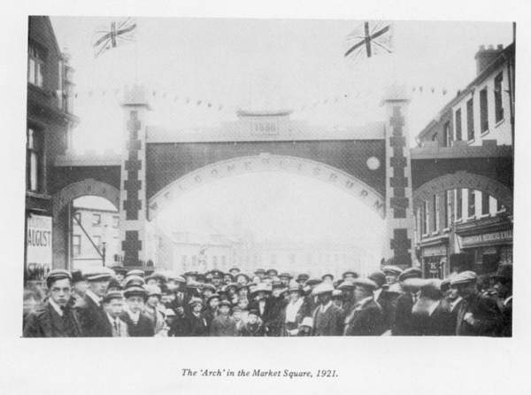
The "Arch" |
After seeing these memorials to all these persons who have
passed on, sit down for a while and give a thought to these good people. If the
sun is shining- or even if its not-look at the window with the Good Samaritan in
lovely coloured glass, and enjoy the quiet of the church. You will be refreshed.
![]()
Burial Grounds in
the District
It is amazing the amount and variety of information which
can be gathered if you keep on asking questions, and this has been the case with
the so-called "Blaris Rebels."
They were not rebels in the accepted sense, but soldiers of
the king whose duty it was to put down the rebellion. They belonged to the
Monaghan Militia, who were encamped at Blaris under Colonel Leslie in May, 1797.
The "Camp Field" at Blaris was used as a camping
place on other occasions, one of which was by King William's troops on his way
to the Boyne. If you go out to the old graveyard have a look at this historic
field where the fate of Ireland may have been decided.
If you search long enough you would probably find an old
bullet or two. Fm sure they have been ploughed up occasionally.
According to Charles Dickson in the "Revolt in the
North," "seventy members of the Monaghan Militia were found to have
taken the United Irishmen's oath, and four were shot at Blaris camp."
This regiment was on duty in Belfast and the court-martial
was held there. Four of the men were found guilty, brought from Belfast to
Blaris, and shot. The names of the men were: Owen McKenna, William McKenna,
Peter McCarron and Daniel Gillan.
In some of the accounts the names differ slightly in the
spelling.
There is a story of white flowers blooming at the spot
inside the graveyard where they are buried, but the white flowers now are those
of a white lilac which is growing at the old wall at the graveyard entrance.
Thus the traditional story is founded on fact, although as
always, a few embellishments may have been added as time moves on and memories
get hazy or more imaginative.
I contacted the Ulster Museum, Stranmillis Road, Belfast,
about the matter and was informed that they had printed records of the event
and, through the kindness of Mr. Turner, I was shown these documents. So, its a
true story.
Old Blaris Cemetery has been very close to momentous
happenings, and if that 1626 headstone could speak, it could tell some stirring
tales.
As we are looking at the last resting places of the people
of Lisburn we now come to the most important one, the Lisburn Cemetery.
This is not an old cemetery when compared with Kilrush, Old
Blaris and Lambeg, but is probably more interesting as being of the period which
most of the present generation and their parents have lived through.
![]()
The deed given by Sir Richard Wallace states:
"Fee-farm grant dated April 12, 1877, the owner to David Beatty, John
Dogherty Barbour, Samuel Musgrave, George St. George, Claude Lyttleton Capron,
James Mussen, Rowland Savage, Robert Allister, Lucas Waring, John Ruddy, John
Ritchie, James Alexander Mack. The deed grants five acres as a site for a burial
ground for the borough of Lisburn. The deed does not reserve any rent"
I would think that the gentlemen mentioned above were the
Town Commissioners, as the Urban Council was not elected until 1899. Did you
notice the words �Borough of Lisburn�? The deed referred to the piece of
ground, then a field and now the Cemetery.
All the graves you see in the cemetery today have gradually
appeared since 1878 when the first interment took place.
To be the first person to be buried in a graveyard is not
an ambition which is very attractive. Nevertheless, someone has to be the first
and in this case it was William John Knox. He was a member of a highly respected
Lisburn family living in Railway Street.
The firm of W. J. Knox & Sons was working under that
name from 1850 until a short time ago, when the premises were taken over by
Kenneth Irvine.
Mr. Knox had gone to Paris to see Sir Richard Wallace about
the town house which Sir Richard proposed building in Lisburn, and while there
he took ill and died, September 18, 1878. He was brought home to Lisburn and
interred in the cemetery on September 24.
At one time the Sandy Lane (Warren Park) was lined with
trees and it is said that the tree under which he used to meet his sweetheart
was beside the grave plot that was chosen. Alas, the tree is not there now; but
Mr. Knox�s white memorial is there close to the Sandy Lane.
The lettering is fading after 92 years and is becoming a
little difficult to read. This is an important grave in the history of the
cemetery and, of course, in the history of the Knox family.
In general appearance there is nothing very spectacular
about the cemetery, just solid respectability, just like Lisburn town. It is
very well kept, everything tidy and just what one would expect to see in an
up-to-date municipal burial place.
On your walk round have a look for the headstone with the
date, 31st February, 1916. How this date came to be cut in the memorial is a
mystery. On the back of the stone is the name of the sculptors, "Kennedy
Belfast." Was it intentional or a mistake? The official record states
"23rd February, 1916." It's most peculiar.
The history of Lisburn is contained in the graves of this
cemetery and a stroll round will remind you of the people you knew well and
others whom you knew only by name. All of them have added something to the life
of the community during the past one hundred years.
All the gave plots having been allotted, the Council had to
look for more room for the rapidly increasing population, and the ground at
Blaris was acquired.
![]()
The New Cemetery at Blaris was opened and the first
interment took place on 22nd January, 1955, and already a goodly number of our
citizens have been laid to rest.
New Blaris is laid out somewhat like the Lisburn Cemetery:
all paths are at right angles or parallel to the others. I think this is rather
regimental, if economic. I wonder would a different layout with winding pathways
have been better. It would have been more artistic and have left spaces for
flowerbeds and seats.
Like its elder brother, Lisburn Cemetery, there are no
trees or bushes. Somehow a yew or a cypress helps to enrich and soften the
appearance and add a touch of antiquity to the scene. They should, however, be
discreetly placed by the local authority.
I remember visiting a little graveyard some miles outside Glasgow. "Denny Cemetery" I think it was. It was almost circular in plan and all the paths wound round and round. A place for tourists to visit and beautifully kept. I suppose its shape was unique.
With the cool breeze from Divis blowing across Blaris we
leave, and on looking back can see the rush and bustle of the traffic on the M.I,
a great contrast to the quiet of the cemetery. It's a case of the "quick
and the dead."
Now to Chapel Hill to visit St. Patrick's Churchyard. It is
at the rear of the church and close to the church wall. St. Patrick's was built
in 1900 on the site of a previous church erected in 1794.
It is a small graveyard and does not appear to be old. The
memorials are dated from about 1850, but there may be others which are not
easily seen. It may not have been in use in very early times, as other
graveyards were available. You will remember that several priests were buried in
Lambeg graveyard.
On looking round you notice the McIlroy memorial, a Celtic
cross. It is a very fine piece of the sculptor's art. At the gate as you enter
the graveyard is a memorial to Daniel McLernan. This grave has an unusual iron
surround. It is ironwork of a high order.
Just beside the graveyard but outside is the "Fairy
Mount" which I have mentioned previously. This churchyard became too small
and the cemetery at Trinity Terrace, Longstone Street, is being used. If you
walk round this more modern cemetery you will see the names of the people of
today, businessmen and workers of Lisburn since about 1900.
The first person interred here was John Downey.
Away over on the Barnfield Road, Deriaghy, is another old
churchyard with some Lisburn names, dated 1842.
The only other graveyard left to be mentioned which was
inside the Lisburn boundary was the Workhouse graveyard. It was at the rear of
the workhouse buildings on the Hillsborough Road. Part of the old buildings can
be seen beside the modern Lagan Valley Hospital.
![]()
This graveyard was under the control of the Board of
Guardians who were responsible for the workhouse and whose office, erected in
1840, was taken down in 1967.
It was for the burial of the workhouse inmates and graves
were unmarked. It had not been in use for a long time and was closed. There used
to be a lane at the top of Hill Street which led down to the mill race beside
the Lagan and this graveyard was over the hedge on the right-hand side at the
bottom.
During the typhus and cholera epidemics and the famine and
unemployment of the 1840s it must have been a busy spot.
Derriaghy Churchyard is another burial place which has been
used by Lisburn people for many years and, of course, the church is very popular
for weddings. It has the old section and today's section.
The old has a good many iron surrounds for the graves and
the new has not. The iron railing is seldom used now but, like all fashions, it
may return with some kind of new metal, like stainless steel. It only takes
someone to start it. The old iron railing must have been a novelty about one
hundred and fifty years ago.
The beautiful old church and the new church hall are again
the ancient and the modern. Not being a youngster myself, I prefer the church
architecture which has stood the test of time and weather for almost one hundred
years, being built on the site of a previous church in 1871. I'm sure there will
be centenary celebrations next year. I hope someone produces a history of the
church and churchyard.
You come to see the churchyard but it is the church front
and spire which commands your attention. The spire, partially covered with Virginia
creeper, has its four sides running up to a needle point with crows or rooks
wheeling round and in and out of the apertures.
The Virginia creeper in autumn, when the leaves have turned
a brilliant shade of red, enhances the beauty of the stonework and makes the
ivy-clad rounded wall on the right look even better. - The sexton told me the
creeper was over forty years old and showed me the hidden date stone on the
spire.
But what about the headstones.
There are some very nice memorials, both old and recent. I
saw one dated 1770, two hundred years old and, I'm sure, not the oldest. There
is also a vault to a previous vicar, the Rev. Philip Johnston, J.P., D.L. Some
very nice polished granite to well-known families and some sandstone partly
covered.
There is one which you should find, a square tapered short column inside an iron railing; it is to Nathaniel Kronheim, a Jew. He was born in Prussian Silesia, became converted to Christianity, and for twenty years he promoted Christianity among the Jews.
There is a little plaque written in Hebrew. It is Psalm
122, verse six. Look it up. He died 1852, aged nearly 80.
The ground level is anything but level, the graves being
mostly on fairly steep ground and it must be difficult to keep everything in
order. The old part especially is of irregular shape, but I think them is beauty
in this kind of irregularity.
From the gate to the church, the fact that the path winds
and you come gradually to full view of the church front, makes a very nice
approach.
I went into the car park and looked over the wall and
across the headstones at the church. The afternoon sun was shining, picking out
the last red leaves of the Virginia creeper. You would almost have been
persuaded that all was peace.
I have now written about the burial places which concern Lisburn people. I do hope that when next you visit my of them (the graveyards) they will be more interesting to you.
![]()