County Tyrone.
BY H. L. GLASGOW.
 WHEREVER Tyrone men meet, in Belfast or Glasgow,
Liverpool, Leeds or London, New York, Toronto or distant Sydney, or in
the loneliest part of the world, however different may be their social
station, or divergent their political or religious views, a single
slogan cements their friendship�"Tyrone among the bushes." The modern
County of Tyrone is not particularly well wooded, but in the old Kingdom
of Tir-Owen, of which the county forms the central part, there were very
extensive forests, up till the beginning of the 17th century, now
well-cultivated arable land. The Kingdom of Tir-Owen was, partly for
that reason, the strongest of the native territories which did not
recognise the conquest by Henry II. of England until the reign of Henry
VIII. The Irish Parliaments met but did not pretend to legislate for
their Kingdoms ; the High Court was set up in Dublin in the 12th
century, but the King's writ did not run in these Kingdoms ; most
striking proof of all of their independence, the Kings claimed, and
exercised to the full, the right to carry on war against each other.
Until The O'Neill of Tir-Owen surrendered his sovereignty in 1542 for
the position of Earl, took his seat in Parliament, and accepted English
law for the old Brehon law, his authority was almost analogous to that
of the Amir of Afghanistan.
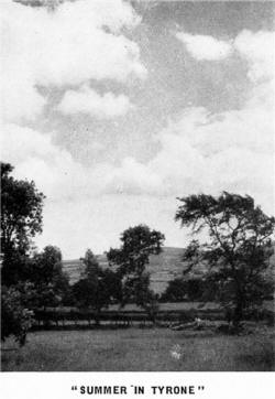 It was this kingdom which was cut up into
the three counties of Armagh in the South, Coleraine (afterwards
Londonderry) in the North, leaving the middle slice to form the County
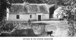
of Tyrone. On the northern side are the Sperrin Mountains, the highest
peak (Sawel, 2,240 feet) being on the boundary of Tyrone and
Londonderry; and the moorland striking south divides Tyrone into two
parts, which were at one time actually regarded as separate counties,
while along the south, from east to west, is the fertile district
commonly described as the Clogher Valley, which formerly was in the
Kingdom of Oriel. It was this kingdom which was cut up into
the three counties of Armagh in the South, Coleraine (afterwards
Londonderry) in the North, leaving the middle slice to form the County
of Tyrone. On the northern side are the Sperrin Mountains, the highest
peak (Sawel, 2,240 feet) being on the boundary of Tyrone and
Londonderry; and the moorland striking south divides Tyrone into two
parts, which were at one time actually regarded as separate counties,
while along the south, from east to west, is the fertile district
commonly described as the Clogher Valley, which formerly was in the
Kingdom of Oriel. But enough of geography and history. " Let us get
there," says the tourist. It is very simple�BOOK THROUGH TO BELFAST VIA
HEYSHAM OR LIVERPOOL, and the journey is convenient as well as speedy.
For example, the traveller can leave London at 6 p.m., dine comfortably
on the train (first or third class), and arriving at either port, go
aboard and turn in before midnight, getting a good night's sleep before
reaching Belfast Lough. Breakfast on board and take the Great Northern
train at 8-25 a.m. for Londonderry. Thus Dungannon, the old capital of
Tir-Owen is reached at 9-31 a.m. ; Omagh, the county town, at 10-13
a.m., and Strabane, on the Free State border, at 10-40 a.m. These are
three of the towns of Tyrone which are Urban Districts, the fourth being
Cookstown, which can be reached by the branch line from Dungannon at
10-10 a.m., or earlier and more speedily by the L.M.S. line from Belfast
over the new loop line, opened on 17th January, 1934, by the Governor of
Northern Ireland, and costing �250,000, to cut 20 minutes from the
journey. Scottish tourists can, with equal convenience, travel by
steamer from Glasgow or Ardrossan, while travellers who want to reduce
the sea voyage to a minimum can cross from Stranraer to Larne, with a
trip on the open sea of only 1�
hours.
 The Road System.
So many tourists bring their own cars, nowadays, for which the
cross-Channel steamers specially cater, and others prefer bus routes for
their sight-seeing, that the road system of Tyrone may be briefly
described. All told, there are 3,200 miles of county roads in Tyrone, of
which 140 miles are Class A, with gradients and surfaces equal to the
average main road in Great Britain. There are 260 miles of Class B roads
not yet all brought up to the same standard, on which some severe hills
and bad patches may be en-countered ; the rest are good, bad and
indifferent; but it should be noted that many of these, in sparsely
populated areas, have excellent surfaces because they are so little
used. The classified roads A and B are distinguished, as in Great
Britain, by numbers, making it easy for the motorist to follow the
correct route from one signpost to another. There are three main
arteries of Class A roads, inter-connected by B roads, and these follow
the three divisions of the county already mentioned. A 4, which starts
at Belfast, enters Tyrone by crossing the Blackwater at Verner's Bridge,
and passing through Dungannon, runs westward, traversing the Clogher
Valley. At Augher it is joined by A 28 (from Newry) and proceeds to
Enniskillen. A 5, which starts at the port of Londonderry, follows the
Valley of the Foyle to Strabane, and running south passes through
Newtownstewart and Omagh, and thence via Ballygawley to Aughnacloy and
the Free State frontier, while a branch (A 32) runs from Omagh
south-west for Enniskillen. A 29, which starts at Portrush, is joined
by A3l from Belfast, skirting Lough Neagh on the north, before it
reaches Tyrone. Passing through Cookstown it runs via Stewartstown and
Coalisland to Dungannon, and thence to Moy, entering Co. Armagh. There
are a few short branches classified as A roads, but those mentioned are
the through routes which can be depended on as good motoring roads ;
they are inter-connected by Class B roads, most of them bus routes, and
by a net work of District roads. The Urban Districts.
There are four principal towns n Tyrone, which are Urban Districts, and
all are provided with good hotels. The tourist should make one or
more of these towns his headquarters, each being the centre of an area
peculiarly its own. We will take them in alphabetical order, and
describe what is to be seen. Cookstown
Is a terminus of the G.N. Railway and the L.M.S. Railway lines, and is
on A 29 road close to the Londonderry boundary. The town is an early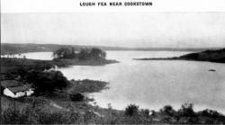 example of town planning, having been laid out in the middle of the 18th
century, with the main street 130 feet wide, and stretching in a
straight line for 1� miles. To the
north, five miles off, as a background to the town, lies Slieve Gallion
mountain (1.760 feet), which can be easily ascended, even by car to the
top, though the road is rough. On the summit is a cairn marking the
burial place of Colla Uais, the 3rd century conqueror of Ulster.
Archeologists will find in the district to the west of Slieve Gallion,
which is a spur of the Sperrins, a great deal to interest them, and much
yet unexplored. Sufficient to say that the latest theory of the Bronze
Age invaders is that they landed at Torr Head in Co. Antrim, travelled
along the coast to Portrush, and moving inland along the mountain ridge,
left a trail of dolmens till they reached Dun Rua, a Bronze Age cemetery
12 miles west of Cookstown, in the townland of Crock�a name given by
them to the hill tops. Geologists are working at the same area in which
they hope to find the solution of problems regarding the Highlands of
Scotland and of Scandanavia. There is a golf course (9 hole) in
Killymoon Demesne, reputed to be the best inland links in Ireland ;
close beside it is Killymoon Castle, built by John Nash, the architect
of Regent Street, at a cost of �80,000, and sold a few years ago for
�100.

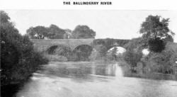 About ten miles from Cookstown, in the easterly direction, a
frequent bus service takes the tourist to Lough Neagh. Halfway is the
village of Coagh�on the Ballinderry, a fine trout river�the wide market
place of which is named Hanover Square�a gesture by the then lord of the
soil who, in 1728, having got a charter for a market, wished to identify
his little town with the house of Hanover. About ten miles from Cookstown, in the easterly direction, a
frequent bus service takes the tourist to Lough Neagh. Halfway is the
village of Coagh�on the Ballinderry, a fine trout river�the wide market
place of which is named Hanover Square�a gesture by the then lord of the
soil who, in 1728, having got a charter for a market, wished to identify
his little town with the house of Hanover. The bus stops a few
minutes' walk from Newport Trench, a little harbour used by fishermen,
where eels may be seen packed for Billingsgate, and pollan (the special
Lough Neagh fish) for Manchester. A mile to the south is the tall stone
cross of Arboe, one of the finest in Ireland, beside an old burial
ground in which is a "wishing tree," and in the adjoining field the
ruins of an abbey, destroyed in a raid by an enemy tribe across the
Lough, three years before the Anglo-Normans first landed in Ireland.
Three miles farther is Washing Bay, with its tradition of healing, and
overlooking it the remains of Mountjoy Fort, built in the Elizabethan
War. Leaving Cookstown by A 29 road (which has a two-hour bus service
to Dungannon), a run of 2� miles
brings us to Loughry demesne, the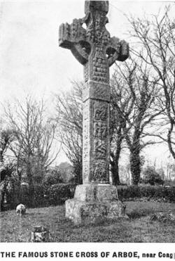 Manor House of which is now the
Government's residential Dairy School for farmers' daughters. Dean Swift
was an intimate friend of the former owners, and the summer-house in
which he used to pen his satirical attacks on whatever displeased him is
shown to visitors. Of the adjoining Priory, nothing remains but the
name, but across the road is Tullaghoge (Teloc-og) Fort, 600 feet high,
where the Kings of Tir-Owen were inaugurated from the 12th till the 17th
century, when the coronation stone was broken by Elizabeth's General,
Lord Mountjoy. Manor House of which is now the
Government's residential Dairy School for farmers' daughters. Dean Swift
was an intimate friend of the former owners, and the summer-house in
which he used to pen his satirical attacks on whatever displeased him is
shown to visitors. Of the adjoining Priory, nothing remains but the
name, but across the road is Tullaghoge (Teloc-og) Fort, 600 feet high,
where the Kings of Tir-Owen were inaugurated from the 12th till the 17th
century, when the coronation stone was broken by Elizabeth's General,
Lord Mountjoy. Stewartstown, midway between Cookstown and Dungannon,
was formerly a flourishing little market. A mile and a half distant is
Drumcairne, the residence of the Viscount Charlemont, V.L., Minister of
Education, and half a mile farther is the Irish seat of the Earl of
Castlestewart, late M.P. for Market Harborough. Stewartstown, sleepy
though it be, has done its share in providing outstanding men, the
latest to be honoured by the King, Sir Stanton Woods, being a son of a
local merchant. He was one of the team of doctors who were in attendance
at His Majesty's recent illness. A nine foot seam of coal, known as
the Anaghmore coal, has been located at Lislea, two miles from
Stewartstown, and is being mined on a moderate scale. It competes with
the best English coal, and is in demand at 30/- per ton at the pit head.
 Dungannon
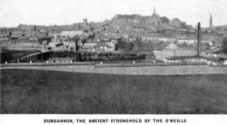 Is compactly built round the dun (or fort) from which it takes its
name, the natural strength of which, in the days before artillery, is
evidenced by the steepness of the streets. It was the capital of Tir-Owen,
and on the top of the hill was the Castle of The O'Neill, of which
nothing but the name " Castle Hill " remains. Is compactly built round the dun (or fort) from which it takes its
name, the natural strength of which, in the days before artillery, is
evidenced by the steepness of the streets. It was the capital of Tir-Owen,
and on the top of the hill was the Castle of The O'Neill, of which
nothing but the name " Castle Hill " remains. The Presbyterian Church
in Scotch Street has historical interest as being the place where the
Irish Volunteers net in September, 1783, to demand the independence of
the Irish Parliament. Dungannon was created a borough by James I. for
his first Parliament after the Plantation, but it was disfranchised by
the Redistribution Act of 1885. Being the then capital, it became the
Assize town, when the judges first went on circuit in Tyrone to
administer English law, but subsequently Omagh took its place. For the
same reason�its prominence in the early part of the 17th century�Dungannon
is strong educationally. One of the Royal Schools founded by James I.
was erected here, and the Education Endowments Commission divided the
revenue it enjoyed from the liberal grant of lands, with the Catholic
Board of Education, which has an Academy in Dungannon. There is also a
High School for girls, managed by the local education authority, for
which a new school is being erected, and the Technical School, which has
outgrown its present premises, is to have similar accommodation. At
Donaghmore, two miles off, is a Convent Boarding School for girls.
Industrially, Dungannon has more than held its own in spite of the
depression in the textile trade, its factories having been enlarged in
recent years. The business of the town, too, has improved considerably
in the last decade, the market being in a flourishing condition, to
which the excellent bus services, in all directions, materially
contributed. Northland House, the splendid seat of the late Earl of
Ranfurly, is close to the town. There are also tennis clubs, hockey
clubs, and golf links, to which visitors are welcomed. Coalisland,
three miles to the north of Dungannon. with a lively appearance, is an
industrial town with many workers. Connected by canal with Belfast and
Newry, it has the advantage of cheap freights, so that its corn millers
and importers of building material and heavy goods can compete
successfully with larger towns on the railway. It has also a thriving
Fire Clay Works and a weaving factory. Before reaching Coalisland will
be seen, on the left, the extensive mine head works of the collieries,
standing idle�a witness to the ambitious attempt to get at the coal
which has been worked, at intervals, for 200 years. The under-lying
clay, however, is used to an increasing extent for bricks, and the
chimney stacks in the valley between Coalisland and Dungannon attest to
the prosperity of this industry. Benburb, an industrial village, six
miles south of Dungannon, off the Caledon road, has, in the Manor House
grounds, a fine sample of the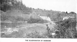 "bawns" built by the early planters, and
also the remains of O'Neill's Castle high over the Blackwater.
Sanguinary encounters took place, both up and down the river, between
the Irish and Scottish armies in the civil war, and at Battleford Bridge
in 1646 a Scottish Army under General Robert Munroe was totally defeated
by the Irish under Owen Roe O'Neill. "bawns" built by the early planters, and
also the remains of O'Neill's Castle high over the Blackwater.
Sanguinary encounters took place, both up and down the river, between
the Irish and Scottish armies in the civil war, and at Battleford Bridge
in 1646 a Scottish Army under General Robert Munroe was totally defeated
by the Irish under Owen Roe O'Neill. Castlecaulfield and Donaghmore,
are two adjacent industrial villages a couple of miles from Dungannon.
The former produces linen, and the latter soap and candles. The Rev.
George Walker, the defender of Derry in 1688, was rector of Donaghmore,
and the Rev. Charles Wolffe, the author of "The Burial of Sir John
Moore," was curate of Castlecaulfield. Donaghmore owns a very good stone
cross, on the public road, and Castlecaulfield has the remains of the
castle erected in 1614 by Sir Toby Caulfield, the founder of Charlemont.
Moy (Or "The Moy" as the natives call it), on the beautiful river
Blackwater, is a ten-mile run by A 29. The village was designed by the
land-owner on a continental model, with a large square dotted with
trees. Its horse fair (first Friday of each month) is the resort of
remount officers from European countries when there are rumours of war.
Pomeroy, the highest town in Tyrone, eight miles from Cookstown, by B 4,
has a weekly market well patronised by the hill folk, and the " hiring
fair," on the Tuesday before 12th May and 12th November, is worth a
visit. Geologists will be interested in the exposures of Silurian rock
at Slate Quarry, six miles from Cookstown. Pomeroy is joined by B 43
with Dungannon, the road going through Carrickmore, across the bog land
to Omagh, with a branch to Sixmilecross�an old coaching station, and
Beragh, at one time named Lowry's Town.
The old road from Dungannon to Omagh passed Cappagh, where copper was
once mined, beyond which was a district where a celebrated robber used
to prey on travellers. A hill 901 feet high, with the name " Shane
Bernagh's Sentry Box" is the only survival of his activities.

Omagh
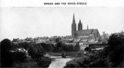 Is the county town, and the administrative centre of Tyrone, with the
fine Courthouse dominating the High Street, where the judges hold
Assizes, but its gaol has been converted to less morbid purposes than of
old. The town has a Military Barracks, the Mental Hospital for Fermanagh
and Tyrone, the County Hospital, the Constabulary headquarters, as well
as the County Council Offices, so that it has a relatively large
official population, and is, in consequence, well equipped with the
amenities of town life. It is also the centre of a large agricultural
area. Is the county town, and the administrative centre of Tyrone, with the
fine Courthouse dominating the High Street, where the judges hold
Assizes, but its gaol has been converted to less morbid purposes than of
old. The town has a Military Barracks, the Mental Hospital for Fermanagh
and Tyrone, the County Hospital, the Constabulary headquarters, as well
as the County Council Offices, so that it has a relatively large
official population, and is, in consequence, well equipped with the
amenities of town life. It is also the centre of a large agricultural
area. Tourists can sample the wild scenery of the Sperrins by a
circular tour from Omagh. Leaving by B 48, the road runs north through
Gortin Gap (eight miles out), with hills on both sides up to 1,700 fret
high. Proceeding by Garvagh Bridge, the road crosses a low spur of the
Sperrins by Barnes' Gap�a wild bit of scenery, and turning right follows
the Glenelly river on the south side to the village of Sperrin, which
lies at the foot of Sawel (2,240 feet), the highest peak of the range,
rather steep except for climbers. The return journey may be made down
the north side of the valley through Cranagh to the pretty village of
Plumbridge, lying in the hollow between two ranges of mountains. From
here B 47 passes Corrick Glen, a famous beauty spot, to Newtownstewart,
joining A 5, and back to Omagh through a good farming district.
Newtownstewart is the best angling centre in Tyrone, and numerous ruined
castles in the district will interest the antiquarian. The road passes
Baronscourt, the palatial residence of the Duke of Abercorn, who, as
Governor of Northern Ireland, resides chiefly at the official residence
at Hillsborough. Fintona, nine miles south from Omagh (by B 122), is
connected with the G.N. Railway by a horse-drawn tramcar. Six miles
farther is Dromore, another typical Tyrone village. From here the
picturesque road runs north to Drumquin, and the tourist can either
return to Omagh by B 50 (9 miles) or continue to Castlederg which lies
in a remote but fertile plain on the Derg river. A steam tramway
connected the town with the G. N. Railway (8 miles). The Woollen Mill at
Spamount is the principal industry. Strabane,
The largest town in Tyrone, and formerly a borough, has a considerable
population engaged in shirt and collar making. Standing on the Mourne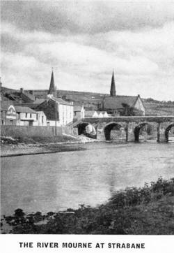 (an extension of the Foyle and tidal as far as Strabane), the town has a
canal connecting it with the port of Londonderry ; and two railway
lines, one on each side of the river also connect it with the same city.
It is also the gateway to Co. Donegal (now named Tirconail), the network
of light railways in which county emerge at Strabane.
 Across the river
is Lifford, the small Assize town and capital of Co. Donegal, and on the
bridge connecting the two towns can be observed the working of the
Customs officers on both sides. The rich plain of Raphoe, lying across
the river from Strabane, was originally part of the Kingdom of Tir-Owen,
but was leased by The O'Neill to The O'Donnel, King of Tirconail. It is
of it that the story is told that O'Neill sent, a curt message to
O'Donnel " Pay me my rent or--," to which O'Donnel made the equally curt
reply : " I owe you no rent, and if ..." Whether true or not, it is
certain that O'Donnel proceeded to build a castle opposite Strabane, in
1526, and when O'Neill hurried with his army from Dungannon to prevent
it he found himself helpless, and abandoned the attempt to hold his
territory, which, on the shiring of these two kingdoms, became part of
Co. Donegal, and consequently is now in the Irish Free State. Sion
Mills, four miles south (A 5), is the seat of a flourishing and
extensive spinning industry, whose workers live in a model village
there. The parish church is worth a visit by students of ecclesiastical
architecture.
At Carricklee, one mile from Strabane (B 85), is a fine golf course,
and the point-to-point races here are the most popular fixtures of the
sort in Tyrone. Donemana, to the north of Strabane (B 49), has a
picturesque ruined castle named Earl's Gift. It is in a prosperous
agricultural district ; Scottish words and forms of speech are still
common amongst the descendants of the original settlers.
Clogher
Valley.
In South Tyrone from the Armagh to the Fermanagh Border runs the
beautiful Clogher Valley. It traverses perhaps the best wooded and
agricultural areas in the county. The first village along this route is
Caledon, a picturesque hamlet 10 miles south of Dungannon (B 45),
situated in a good pastoral country. The seat of the Earl of Caledon is
nearby. Augnacloy, almost on the border of Co. Monaghan, is
another 10 miles run from Dungannon (by B 35). It is the only place in
Tyrone under a Board of Town Commissioners, who own the markets and
generally make enough to avoid a rate for lighting, cleaning and other
services under the Towns Improvement Act. It is the headquarters of the
Clogher Valley Railway. Dungannon is joined to the Clogher Valley by
A4 road from Portadown to Belfast. Skirting the hilly land in the centre
of the county, it joins A 5 (from Londonderry) at Ballygawley, a little
market town. Thereafter the road is shared with the primitive light
railway, whose trains at one place run along the side of theroad, and
ever and anon disappear through the hedge to avoid too stiff a gradient,
re-appearing on the road farther on, while at Fivemiletown the train
takes the centre of the main street. The rolling stock has been recently
supplemented by a couple of Deisel engined cars for passengers. William
Carleton was a native of the district, which supplied him with the
material for his "Traits and Stories of the Irish Peasantry," and other
tales, racy of the soil.
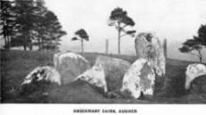 Augher and Clogher, adjacent villages on the
route; were boroughs, returning members to the Irish Parliament. The
latter was also the original Cathedral town of the diocese. The present
building is modern, but in the church and in the churchyard the
antiquarian will find much of interest�the Clogh-or, from which the
church took its name, and believed to be a pagan idol, is one of the
objects of interest. The archaeologist will find in Knockmany, a rather
steep hill a few miles off, stone memorials of a long past civilisation. Augher and Clogher, adjacent villages on the
route; were boroughs, returning members to the Irish Parliament. The
latter was also the original Cathedral town of the diocese. The present
building is modern, but in the church and in the churchyard the
antiquarian will find much of interest�the Clogh-or, from which the
church took its name, and believed to be a pagan idol, is one of the
objects of interest. The archaeologist will find in Knockmany, a rather
steep hill a few miles off, stone memorials of a long past civilisation.
Fivemiletown is the last station on the Clogher Valley Railway in Co.
Tyrone before it comes to Co. Fermanagh . It is a neat little village,
with a good golf course. Close by is Blessingbourne, the seat of
Major-General Hugh de F. Montgomery, and the birthplace also of his
brother, General Sir Archibald Montgomery-Massingberd, Chief of the
Imperial General Staff, and of Sir Hubert Montgomery, British Envoy and
plenipotentiary at The Hague.

Afoot in Ulster.
BY WILFRID M. CAPPER.
 COME ! Let's away for a tramp round Ulster,
away from dull bricks and pavements of cities and towns, out across the
moors and down the valleys. The countryside is beautiful ; let us enjoy
it, and enjoy it in the way which many of us consider the best�on foot.
Let us wander at will over the purple heather of the Mourne or Sperrin
Mountains, down those shady glens of Antrim, peeping in at the open door
of a white-washed cottage here and there to bid the time of day to the
kindly peasant folk within. This time I shan't ask you to pack your
rucksack or don your nailed boots. Our ramble just now will be but in
fancy�a hike of the imagination ! We shall have all the fun of an
open-air tramp without those blistered feet or that aching back !
Starting from Belfast we shall first turn our faces southwards to where
the blue peaks of the Mournes rise out of the Irish Sea. The Mourne
range is fascinating country for walking, but let us not be in too much
hurry to reach it or we shall be apt to miss, as so many others have
done, that stretch of countryside lying right in the heart of County
Down between Slieve Croob and the main mass of the Mournes. It is a
little district which somehow seems to have been overlooked, but it is
perhaps to this circumstance that it owes its charm of unsophistication.
If we make our way to the crest of Slieve Croob we shall have a
magnificent view of the whole of County Down and far beyond. Away
northwards lie the hills of Antrim, and to the west the pale sheen of
Lough Neagh melts into the blue of the hills beyond. Nearer at hand is
Belfast Lough, and just over there, to the right, Strangford Lough up
which many centuries ago the Danes sailed in their strange craft to
settle and give the Lough its name. Into that same Lough, too, sailed
St. Patrick to land at Saul and start his Christian mission. Southwards,
glittering in the sun, are the waters of the Irish Sea, and the bold
outline of the Mournes � Donard, the jagged peaks of Slieve Bearnagh,
and further off, just appearing through the Hare's Gap, the massive
granite tops of Slieve Bignian. Right below us dotted with little
white-washed farm houses and cottages lies the enchanting district of
Legananny. The hummocky surface of Co. Down has been
compared to a basket of eggs, and nowhere is the simile more apt than
here. Descending from Slieve Croob over the peaty top of Cratlieve we
come to the ancient cromlech, standing as it has done for centuries, to
mark the tomb, perhaps of a once-powerful Druid King. It is historic as
well as pretty this countryside, and we shall pass the scene of many a
battle of long ago. It is a spot where we might linger for days, but
just now we must hurry onwards, for we have much to see on our tour and
the call of the Mournes is strong.
 The" Kingdom" of Mourne,
As this district is generally called, has a folk lore all its own ; it
is a kingdom apart, with its own traditions and its own
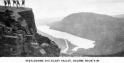
humour. It is, too,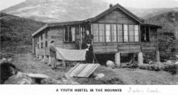 probably the finest tramping country in Ulster, if
not in the whole of Ireland. Its mountains offer an endless variety of
walks and climbs. Slieve Donard, the highest peak in Ulster, rises to
2,800 feet, and there are a dozen others over 2,000 feet. To those who
wish to get away from things mundane, the Mountains of Mourne are a
heaven-sent refuge. Here we may wander at will for days on end through
glorious valleys and over rugged heather-clad peaks without once meeting
either man or beast. Who could forget a tramp on a summer morning from
Poulaphouca�the `" Glen of the Fairies "�through the Hare's Gap and by
the goattrack�the " Brandy Path " of the old smuggling days�along the
slopes of Slievenaglogh to the "Castles" of Commedagh, where nature has
outstripped man in her construction of a mighty battlement of towers and
turrets of solid granite ? Or who could forget a walk by moonlight up
the valley of Dunnywater to watch the quivering disc of the moon on the
deep waters of the Blue Lough ? probably the finest tramping country in Ulster, if
not in the whole of Ireland. Its mountains offer an endless variety of
walks and climbs. Slieve Donard, the highest peak in Ulster, rises to
2,800 feet, and there are a dozen others over 2,000 feet. To those who
wish to get away from things mundane, the Mountains of Mourne are a
heaven-sent refuge. Here we may wander at will for days on end through
glorious valleys and over rugged heather-clad peaks without once meeting
either man or beast. Who could forget a tramp on a summer morning from
Poulaphouca�the `" Glen of the Fairies "�through the Hare's Gap and by
the goattrack�the " Brandy Path " of the old smuggling days�along the
slopes of Slievenaglogh to the "Castles" of Commedagh, where nature has
outstripped man in her construction of a mighty battlement of towers and
turrets of solid granite ? Or who could forget a walk by moonlight up
the valley of Dunnywater to watch the quivering disc of the moon on the
deep waters of the Blue Lough ? It is well, then, that the Youth
Hostel Association has provided four hostels in this beautiful
district�all of them in perfect situations. Slievenaman hostel is just
below the Hare's Gap, the natural gateway to the mountains from the
north. Bloody Bridge Hostel is built amidst the heather of
Slievenagarragh, after the fashion of a mountain chalet with the front
entirely of glass, to afford an uninterrupted view over mountains and
sea. The most southerly hostel is at Killowen, the birth place of Lord
Russell, perhaps England's greatest Lord Chief Justice. It is built on
Gilbert's Hill on a lovely site by the shores of Carlingford Lough.
Leitrim Lodge Hostel�formerly a shooting lodge�lies in a most lovely
valley mid-way between Slievenaman and Killowen.
It is hard to leave this spot "where the Mountains of Mourne sweep down
to the Sea," but we must hurry on to Camlough,
En route for the Lake District of Northern Ireland. On our way
thither let us take a glimpse at another of those pretty, out-of-the-way
and little-known places�the Camlough country in County Armagh. This
district amidst the most westerly spurs of the Mournes is well worth
exploring, and rejoices the heart of the traveller on foot who wishes to
get off the beaten track. He has only to climb from the shores of the
lake to the summit of Slieve Gullion, throw himself down on the soft
heather, and let his eyes wander over the pleasant hills and Carlingford
Lough to revel in the beauty of nature.
 Clogher Valley.
One of the glories of Northern Ireland is in the diversity of its
scenery. When we leave southern Armagh for County Fermanagh, we
pass by way of mid-Armagh and South Tyrone, along the beautiful Clogher
Valley. For those who are wishful of a rather less strenuous type of
walking, this district has a strong appeal.
The County of The Lakes.
We travel west-wards through a rich pastoral countryside to Fermanagh,
whose great attraction is the Upper and Lower Loughs of Erne,
studded with tiny tree-covered islets and surrounded by a richly wooded
country. The lakes are perhaps seen at their best from a boat, but for
the rambler not wishing to leave the shore excellent walks abound
everywhere. Just here the camper scores over the walker who must
return at nightfall to the shelter of an hotel. Camping by the shores of
these lakes is exhilarating, and our first amble through the woods along
the lake shores in the cool of the evening will not readily be
forgotten. Even the least romantic must be moved by the sight of those
great trees silhouetted against the clear sky, and the still waters of
the lakes running into innumerable little bays and creeks that make the
picture seem almost unreal. There is an endless outlet for exploration
in this charming corner of Ulster.
The Sperrin Mountains.
Travelling northwards and eastwards from the Lakes of Fermanagh,
we soon strike the great Sperrin Range, covering large tracts of
North Tyrone and South Londonderry. The country has changed again and we
are now amid rolling moorlands�a wild country that offers a fine range
of walks for those who desire the gentle slopes. At the head of richly
wooded Faughan Valley, almost under the great mass of Sawell, the
highest peak in the Sperrin range, another Youth Hostel has been
provided. This hostel�Tamnagh Lodge�was also a former shooting box.
Dropping down from the northerly foot-hills of the Sperrins we reach
The Valleyof the Roe,
Which runs through Limavady to Lough Foyle. We may either
follow the stream down to the Dog's Leap in the " Gorge of the Roe" or
keep to the high ridge of hills to the west. In either case we should
not fail to climb Benevenagh, the final rise of the ridge, and explore
the great cliffs which extend from Bellarena to Downhill. The Coast
and Glens of Antrim.
 And now we come to County Antrim, possibly the best known of all
the counties of Ulster�and not without reason. It is true it
does not possess the awe-inspiring granite peaks which are the glory of
the Mountains of Mourne, but it has sixty miles of an incredibly
beautiful coastline and quiet beauty in its lovely glens. There is music
even in its names, listen � Portaleen, Corrymeela, Trostan, Crockaneel,
Bohilbrega. And now we come to County Antrim, possibly the best known of all
the counties of Ulster�and not without reason. It is true it
does not possess the awe-inspiring granite peaks which are the glory of
the Mountains of Mourne, but it has sixty miles of an incredibly
beautiful coastline and quiet beauty in its lovely glens. There is music
even in its names, listen � Portaleen, Corrymeela, Trostan, Crockaneel,
Bohilbrega. I think the best way for the shuler to see North Antrim is
to follow along the tops of the giant headlands � the Giant's Causeway,
Kenban Head, Fair Head (by the Grey Man's Path), Tor Head and all the
rest of them. From the top of the cliffs we may see the great Atlantic
breakers dashing themselves against the rocks far below, and watch the
gulls circling like small white butterflies over a sea of deepest blue.
Out across the waters of Moyle is Rathlin Island, and beyond the pale
blue hills of Scotland. Here and there between the headlands little
shingly bays come running in, tempting us to bathe in the clear water.
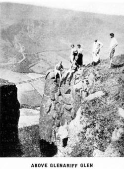
At Glenariff we shall turn inland to explore the glen, and then for the
rest of our wanderings southwards keep to the high ridge which runs
parallel with the coast, dropping down to the little seaside hamlets
only at nightfall. Skyline walking has a particular fascination, but
those who prefer the road will find an excellent main road which hugs
the sea-shore all the way from Cushendall to Larne, and they will
discover lots of interesting things on the way. The road itself was
built as a relief work during the great famine of 1844/47, and at Garron
Point a memorial has been cut in a rock face by the side of the road to
the Quakers who sent over maize from England during those terrible
years. In County Antrim there are five Youth Hostels�on the shores of
White Park Bay, near the Giant's Cause-way ; at Ballyvoy, within easy
reach of Fair Head ; in Glendun, near Cushendun ; at Parkmore, at the
head of Glenariff, almost 1,000 feet up ; and at Straidkilly,
overlooking the Bay of Carnlough. What can be more enjoyable after a
long day on the hills than to gather round the common-room fire and
exchange experiences with others like yourself who travel afoot. Our
magic carpet (or magic boots ?) has given us a brief glimpse of a little
of the beauty of Ulster, but to appreciate it we must wander through it
leisurely. Only thus can we get really to know it, and to know it is to
love it.

Golf in Northern Ireland.
By JAMES HENDERSON,
Chairman Ulster Provincial Council of the Golfing Union of Ireland.
APART from the excellent golfing qualities of many of the courses�some,
indeed, are world famous the visitor will find two marked features of
golf in Northern Ireland--its comparative cheapness and its lack of
congestion. Seldom will he be called upon to pay more than 4/- per day
in green fees, except perhaps on Saturdays and Sundays at certain links
; and he will find that the average fee is 2/6 or 3/6 per day. Weekly
tickets vary in cost between 10/- and 30/-, and in some places there are
concessions to visitors staying at certain hotels. Fees for caddies,
too, are cheap as compared with those in force at British or Continental
holiday resorts, and the caddies themselves are alert and intelligent.
As for congestion, it scarcely exists. At one or two seaside courses
during the summer months the time-sheet for starting is brought into
operation, but for the remainder of the year a days golf may be played
at these courses without the slightest "hold-up." Even at the suburban
courses in Belfast the visitor will find it possible to get a game in
comfort and without delay, provided, of course, that he does not seek to
play a round in the late evenings when the members are out in full
force.
The visitor's choice of golf in Northern Ireland is not restricted. He
may play on the celebrated seaside links at Portrush, Newcastle,
Castlerock or Portstewart, or he may sample the excellent inland golf
provided in Belfast and elsewhere.
Taking the seaside links first, those of the Royal Portrush Club on the
shores of the Atlantic, near the famous Giant's Causeway, may be
specially mentioned. The club has three courses, of which the longest
(or No.1) .one of the most spectacular in the world, and is destined to
become one of the world's greatest. It was opened for play at Easter,
1933, being laid out partly on land occupied by the old course, and
partly on new country. It is about 6,500 yards long, and is capable of
being "stretched" to about 7,000 yards, and it not only embodies all the
most modern ideas of golf course architecture, but affords views of land
and sea that are not to be excelled for grandeur in any part of the
British Isles. It is a championship course par excellence, but by
deft manipulation of the enormous acreage of land available the
designers have arranged the fairways and the hazards in such a manner
that the holiday golfer can enjoy himself to his hearts content without
encountering exceptional difficulties. The No. 2 course is mainly (but
not wholly) for ladies, and, if it were not for the proximity of the
No.1 course, it too would be reckoned of championship class. And then
there is a short course for beginners and others.
The No.1 course will, in September 1935, be the venue of the Irish
(Open) Amateur Championship, one of the most important events of the
golfing calendar in the British Isles, the holder of the title being the
fine young Scottish golfer, Hector Thomson.
While at Portrush, the visitor must sample the qualities of Castlerock
and Portstewart, both of which are within a few minutes' drive by car
from Portrush, and both of which have been the venues of several Irish
championships, amateur and professional. They are both excellent courses
and are well kept, while the club house accommodation leaves nothing to
be desired. Then, in the same area, there is Ballycastle, a pleasant
course, partly seaside and partly inland, in one of the most charming
holiday resorts in Northern Ireland.
In the southern part of the province there is New-castle, the home of
the Royal County Down Club. This is a course of the truly majestic type.
Not anywhere in the world are there to be found more gigantic sandhills,
and the spaciousness and graciousness of the whole place are features
which must impress even the most unimaginative of golfers. The course is
about 6,400 yards long, and can be "stretched" to nearly 7,000 yards. It
is constructed in two " loops," and affords a complete test of a
golfer's skill, especially with his wooden clubs. It was the scene in
September, 1933, of the first four-cornered amateur international golf
tournament ever held in Ireland, and it has been frequently the venue of
championships, including the ladies.
This year (1935), Newcastle will be the venue of two big
championships�the Ladies' (24th�31st May), and the Open Championship of
Ireland (23rd�26th July).

Of the other courses in Northern Ireland, of which there are about 55,
that of the Royal Belfast Club at Craigavad, may now be mentioned. Royal
Belfast is Ireland's premier golf club, having been founded in 1881. It
started its career at The Kinnegar, Holywood, then it migrated to
Carnalea, on the shores of Belfast Lough, near Bangor ; and a few years
ago it purchased a lovely estate at Craigavad, also on the shores of the
lough. The course is about five or six miles from the City of Belfast,
and is easily reached by train or motor vehicle. Craigavad is not a
truly seaside course in that the turf is of an inland type, but it is
dry and springy and the greens are excellent. The course is laid out in
two loops, is of good length (6,140 yards), and while hilly is not
fatiguing. It is picturesque to a degree, and commands lovely. views of
Belfast Lough and the Co. Antrim coast. he clubhouse is the most
imposing in all Ireland, being a country mansion converted, Lawn tennis
on specially constructed hard courts is a feature of club life at
Craigavad as well as the golf, and there are magnificent gardens and
woods.
Belfast itself has eight courses, of which the majority are of eighteen
holes. They are all extremely convenient to the city, the municipal
transport (tramways or omnibuses) passing the gates of most of them.
They are :�Malone (5,900 yards), a beautifully situated course on the
southern outskirts of the city, and the venue of the Open Championship
of Ireland, 1933 ; Belvoir Park (6,400 yards), a comparatively new
course in the picturesque demesne of the same name owned by Lord
Deramore, and destined to be possibly the finest inland course in
Ireland Knock (6.100 yards), adjoining the famous Ards Circuit, on which
the Royal Automobile Club's Tourist Trophy Race is run ; Cliftonville
(18 holes), breezily situated near the slopes of the Cave Hill ;
Balmoral (18 holes), on the southern outskirts of the city ; Shandon
Park (18 holes) ; Ormeau (9 holes), situated in one of the city's public
parks ; and Fortwilliam (18 holes), on the north side of the city,
sheltering under the Cave Hill, and enjoying glorious views.
Near Belfast there are numerous other courses, notably Holywood (18
holes), while most of the provincial towns have golfing facilities close
at hand, too.
The flourishing and progressive seaside resort of Bangor, Co. Down, has
three 18-hole courses within easy reach. One, belonging to the Bangor
Golf Club, is practically within the boundaries of the borough. It has
recently undergone extensive alterations ; indeed it may be said to have
been altered out of all recognition, for additional land was secured and
the course almost entirely re-designed and lengthened. The Bangor
Borough Council maintains a public course at Carnalea, and at Conlig,
near Bangor, an 18-hole course adjoins the demesne of the Marquis of
Dufferin and Ava at Clandeboye. Further along the North Down coast there
is a course of 18 holes at Donaghadee, a delightful seaside resort much
in favour with Belfast people ; and another of 18 holes at Kirkistown
Castle, on the shores of Cloughey Bay. Also in Co. Down are to be found
the courses of the Ardglass Club (9 holes), and that of the Warrenpoint
Club (18 holes). The last mentioned is in the vicinity of Rostrevor, one
of the beauty spots of Northern Ireland.
On the Co. Antrim side of Belfast Lough may be mentioned the 9-hole
course of the ancient town of Carrickfergus. The busy and flourishing
town and seaport of Larne has two courses, both of 9-holes, one on the
outskirts of the town and the other delight-fully situated on
Islandmagee, enjoying superb views of the Co. Antrim coast and (on clear
days) of the Scottish coast.
Sunday golf is not universal in Northern Ireland, but it may be enjoyed
in many districts. At most of the courses mentioned above it may be
played, but without caddies, Warrenpoint and one or two others being the
exceptions.

Alphabetical List of Golf Clubs
WITH THEIR SECRETARIES OR HON. SECRETARIES,
NUMBER OF HOLES,
AND STANDARD SCRATCH SCORES.
Further information regarding Green Fees, etc., can be had from the
various Secretaries, and also from the Offices of the
Ulster Tourist Development Association. Ltd.
|
|
Holes |
S'dard Scratch Scores |
Green Fee Per Day |
|
BELFAST. |
* BALMORAL.
Sec., Capt. T. S. Forster, c/o Golf Club,
Hon. Sec., R. W. Stuart,
3 Central Ave., Marlborough Park . |
18 |
73 |
2/6 |
* BELVOIR PARK.
R. Stanley Drean, F.C.A., Ocean
Bldgs., Belfast |
18 |
76 |
2/6 |
CLIFTONVILLE
A. H. McMillan, A.S.A.A.,
113 Royal Avenue, Belfast . |
18 |
70 |
2/6 |
* FORTWILLIAM.
James
Campbell, 36
Hopefield
Avenue. |
18 |
72 |
2/6 |
* KNOCK.
Sec., Clubhouse, Dundonald, Co. Down. |
18 |
73 |
3/- |
* MALONE.
C. S. Harden, Ardcoombe, New Forge Lane, Belfast
. |
18 |
73 |
2/6 |
ORMEAU.
J M. Russell, c/o Golf Club . |
9 |
71 |
2/- |
SHANDON PARK.
S. Nevin, Kingsden Park, Knock, Belfast. |
18 |
73 |
2/6 |
| |
|
|
|
|
CO. ANTRIM. |
* BALLYCASTLE.
Wm. H. Belford, Fleurville,
Ballycastle. |
18 |
71 |
3/- |
BALLYCLARE.
J. Hadden, Cooleen, Ballyclare . |
9 |
64 |
2/- |
BALLYMENA.
J. N. Lamont, Edenagrena, Ballymena. |
9 |
71 |
1/6 |
BUSHFOOT (near Bushmills).
Joseph Black, Portballintrae, Bushmills |
9 |
61 |
1/6 |
CARRICKFERGUS.
David Law, Hopefield, Carrickfergus
. |
9 |
70 |
2/- |
CRAIG'S PARK.
Miss J. O'Neill, c/o Golf Club, Cullybackey |
9 |
65 |
1/- |
DUNMURRY.
W. S. Ritchie, c/o Golf Club,
Dunmurry |
9 |
72 |
2/- |
GREENISLAND.
W. Byrtt, c/o Golf Club, Greenisland |
9 |
70 |
2/- |
LARNE (Course, Islandmagee)
T. A.Purdon, The Mount, Larne
Harbour |
9 |
73 |
2/- |
LARNE TOWN.
David Logan, 37 Victoria Street, Larne |
9 |
70 |
2/- |
LISBURN.
S. Wilson, c/o Golf Club, Lisburn |
9 |
71 |
2/- |
MASSEREENE, Antrim.
W. J. Wilgar, Northern Bank, Ltd
Antrim . |
9 |
71 |
2/- |
PORTRUSH ROYAL (two Courses)
Capt. G. C. Nash, Clubhouse, Portrush |
18 |
75 |
3/6 |
| SHANE'S PARK . |
6 |
66 |
- |
WHITEHEAD.
J. L. T. McAdam, Argonaut, Windsor
Ave., Whitehead |
9 |
66 |
- |
| CO. ARMAGH. |
ARMAGH.
A. W. Emerson, 9 Woodford Terrace |
9 |
70 |
2/- |
LURGAN.
H. C. Malcolm, Bengal Place, Lurgan |
9 |
76 |
2/- |
PORTADOWN.
Alfred Lynas, B.A., Ardbree, Portadown |
18 |
- |
- |
TANDRAGEE.
G. C. Dickson, Tandragee |
9 |
70 |
2/- |
| CO. DOWN. |
ARDGLASS.
Lyle Reid, Belfast Bank, Downpatrick |
9 |
70 |
2/- |
BANBRIDGE.
W. E. Holton, Banbridge.--
R. W. Connor, Seapatrick, Banbridge . |
9 |
73 |
2/- |
BANGOR MUNICIPAL, Carnalea
Town Clerk. Town Hall, Bangor |
18 |
72 |
2/- |
* BANGOR.
J. A. Hurst, Golf Club, Bangor |
18 |
- |
2/6 |
BELFAST, ROYAL, Craigavad.
T. Phenix, Clubhouse, Craigavad |
18 |
74 |
3/6 |
CLANDEBOYE, Conlig.
Miss E. Thompson, c/o Clubhouse, Clandeboye Golf Course, Conlig, Co. Down |
18 |
74 |
2/6 |
* CUAN.
J. W. MacMurray, Strangford, Co. Down |
9 |
66 |
1/6 |
* DONAGHADEE.
A. McMillan, Sec. Golf Club, Donaghadee |
18 |
68 |
2/6 |
*DOWN, ROYAL COUNTY, Newcastle
|
18 |
74 |
3/6 |
F. H. Rogers, c/o Golf Club, Newcastle
|
18 |
- |
2/- |
DOWNPATRICK.
J. McMeekan, Circular Road |
9 |
74 |
- |
HELEN'S BAY.
J. L. Bennet, Helen's Bay. Co. Down |
9 |
70 |
2/6 |
HOLYWOOD.
H. J. Small, Ardlee Avenue, holywood |
18 |
70 |
2/6 |
KIRKISTOWN CASTLE
W. E. Anderson. Ardenza, Cloughey |
18 |
73 |
1/6 |
* MAHEE ISLAND.
David A. Boyd, Damlin Lodge, Mahee Island, Comber |
9 |
71 |
1/6 |
SCRABO, Newtownards.
Hon. Secretary, Golf Club |
9 |
67 |
2/6 |
SPA, THE, Ballynahinch.
John H. Mcllveen, Eden-a-vadle. Ballynahinch, Co. Down |
9 |
69 |
2/- |
* WARRENPOINT
Capt. Barcroft, c/n, Golf Club |
18 |
71 |
2/6 |
| CO. FERMANAGH. |
|
|
|
ENNISKILLEN.
Thos. Smith, Golf Club, Enniskillen |
9 |
69 |
2/- |
| CO. LONDONDERRY. |
CASTLEROCK.
Major E. S. Hancock, c/o Golf Club Castlerock |
18 |
73 |
2/6 |
DERRY, CITY OF
F. A. Hare, 35 Chapel Road, Derry |
18 |
72 |
2/6 |
| KILREA . |
9 |
65 |
- |
| PORTSTEWART (two Courses) |
18 |
74 |
2/6 |
| Secretary, c/o Golf Club |
18 |
68 |
2/- |
| CO. TYRONE. |
DUNGANNON.
S. Thompson, 8 Howard Terra. |
9 |
69 |
1/- |
FINTONA.
G. R. Lacey, Hibernian Bank. Ltd. Fintona |
9 |
67 |
1/6 |
FIVEMILETOWN.
S. Gamble, Ph.C., Fivemiletown |
9 |
68 |
1/6 |
KILLYMOON.
J. D. Devlin, Loy Hill, Cookstown |
9 |
69 |
2/- |
NEWTOWNSTEWART.
W. Ross Henderson, Newtownstewart |
9 |
64 |
2/- |
* OMAGH.
J. Hoey, Ulster Bank, Ltd.- M. F. Donelan, Provincial Bank, Ltd Omagh, Joint Hon. Secs. |
9 |
62 |
2/6 |
* STRABANE.
A. Gallagher. D.L.. Greenmount House Strabane |
9 |
66 |
2/- |
| CO. DONEGAL (Irish Free State). |
NORTH-WEST, Lisfannon, Fahan (8 miles from Derry City).
J. Thornton Towers. 6 Crawford Square, Londonderry |
18 |
72 |
2/6 |
|
* Denotes Sunday play permitted.
In most Clubs Green Fees are increased on Sundays, Saturdays, and Public
Holidays. Weekly and Monthly Tickets can be had at reduced rates.
A reduction in Green Fees for Ladies also exists in most cases, but they
are debarred in some Clubs from playing on specified days and between
certain hours. |
 |